
{{product.productLabel}} {{product.model}}
{{#if product.featureValues}}{{product.productPrice.formattedPrice}} {{#if product.productPrice.priceType === "PRICE_RANGE" }} - {{product.productPrice.formattedPriceMax}} {{/if}}
{{#each product.specData:i}}
{{name}}: {{value}}
{{#i!=(product.specData.length-1)}}
{{/end}}
{{/each}}
{{{product.idpText}}}

... the creation of mesh models by generating high-quality point clouds. Powered by a 45 MP orthographic internal camera, the system provides high-resolution image mapping textures for efficient 3D model reconstruction with ...

... status information of the system, simplifying operation and configuration. The exceptional network capability of the iCON gps 60 allows you to work with SmartNet and other RTK networks aimed at high-accuracy ...

R26 Surveying System Rover+Base R26 integrated Beidou/GNSS receiver is a built-in large-capacity battery, large-capacity memory card, integrated multi-functional high-precision inertial navigation ...

... full-frequency antenna, and multiple frequency points in the whole system High-precision positioning and orientation boards, Bluetooth, inertial navigation, radio and other modules. GNSS Surveying ...


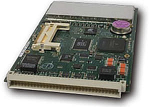
... on GPS, GLONASS and now Galileo satellite signals. Designed for integrators who demand the ultimate in performance, the G3160T is able to withstand 30 g acceleration and output precise position computations at a high ...

●Outstanding Waterproof Capability ●Extremely Rugged Housing ●Advanced OLED Screen ●Inbuilt Radio Transmitter ●Inbuilt Double Batteries ●Inbuilt GPRS/GSM Module New S86 Adhering to the excellent quality and creating the ...
Please specify:
Help us improve:
remaining