
{{product.productLabel}} {{product.model}}
{{#if product.featureValues}}{{product.productPrice.formattedPrice}} {{#if product.productPrice.priceType === "PRICE_RANGE" }} - {{product.productPrice.formattedPriceMax}} {{/if}}
{{#each product.specData:i}}
{{name}}: {{value}}
{{#i!=(product.specData.length-1)}}
{{/end}}
{{/each}}
{{{product.idpText}}}
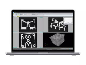
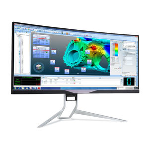
An advanced highly intuitive industrial CT scanning software Fully automated data acquisition and volume processing with most of Waygate Technologies industrial computed tomography systems Fully automated data acquisition ...
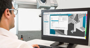
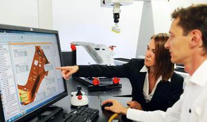
... Flexible metrology software to create and execute measurement routines then collaborate on the results Supporting systems from coordinate measuring machines (CMMs) to portable measuring arms and laser ...

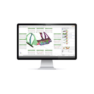
... ? QUINDOS is the leading modular metrology software for special geometries used for powertrains in aerospace, energy, automotive, and engineering. Powerful enough to handle the most complex and demanding ...
... the product lifecycle.eMMA collects shop-floor data from dozens of metrology systems and aligns it with managed quality control routines for automated and on-the-fly analytics. The software offers native ...

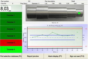
The easy way to get from the drawing to the measurement ZEISS CALYPSO With ZEISS CALYPSO, you will measure standard geometries easily, quickly and reliably. A single mouse click on the required characteristics is all that is needed for ...
ZEISS Industrial Metrology
... calibration software tool generally used for user-specific metrology operations. The software features adjustment, checking, and calibration capabilities from the whole SPY RF® line, ...
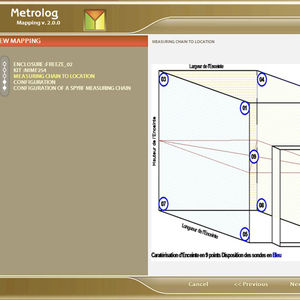
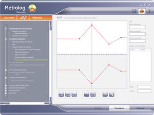
Metrology software allowing to map and check any climatic cabinets according to French norm FD X 15140 or the European one CEI 60068 3-5/3-11. METROLOG2 Mapping is a complete solution which allows ...
... networks Data acquisition, processing and reporting software, able to handle networkly thousands of AQMS stations and monitors in a town, city or region. The XR® environmental management software ...
... contracer and shadowgraph techniques. Use Inspect with GapGun® or Vectro® laser measurement systems to easily perform offline metrology checks. Inspect enables live analysis of complex shapes that include aeroengine ...
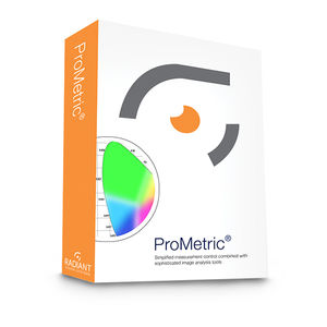
... sophisticated image processing and defect detection applications, consider TrueTest™ Automated Visual Inspection software. ProMetric Software Provides: Complete luminance and color measurement data ProMetric ...
Radiant Vision Systems
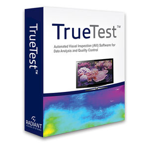
... assemblies and surfaces, multiple tests may need to be performed to inspect products for a range of evaluation criteria. TrueTest™ Software equips ProMetric® Imaging Colorimeters and Photometers to be used for in-line ...
Radiant Vision Systems
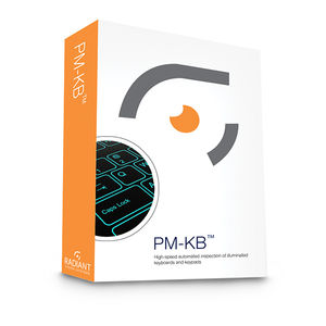
... may strongly impact product usability. A member of the Radiant Vision Systems ProMetric Software family, the PM-KB system combines application-specific software and a ProMetric® Imaging Colorimeter ...
Radiant Vision Systems
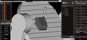
... of parts in 3 and 5 axis machine tools. It is the first metrology software that is easily connected to the control of the machine, providing it with metrological capabilities. Innovalia Metrology, ...
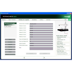
MH-CHECK is an innovative system that seeks to take metrology to the next level and offer a fast, reliable solution to machine-tool checking needs. Its main characteristics are explained below. The MH-CHECK system is ...

•Autoprogramming •Barcode •LivepictureOfyourpart •Automaticmeasurementreport •Offlifunction MTLSOFTWARE Metrology software for Windows: measurement on the picture with automatic scanning…Staticor dynamic ...

F.lli Rotondisells and directly installs on our machines the Metromec measuring software – one of the best in metrology. Here are some of the Software’s key strengths: • User Friendly; • ...
Proven in the most challenging application environments CAMIO is the CMM software of choice for many of the world’s largest manufacturers. By leveraging the productivity benefits of CAMIO, manufacturers can focus on accelerating ...
... in software form in various versions. There is the RF Monitor Premium software that is useful for applications involving only one computer, that is, single-site installation. Users are connected to a ...
ZEISS CALYPSO is your universal software for dimensional metrology and measures standard geometries easy, fast and reliably. ZEISS offers you numerous software options for the software ...
ZEISS Métrologie industrielle
... manufacturing environments. The FARO BuildIT Metrology Software product simplifies these processes with real-time guidance tools, advanced algorithms and easy-to-set-up automation. It’s the industry’s ...
FARO

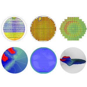
... reconstruction of surface topography from one or several SEM images • 3D visualization at any zoom level or angle plus surface metrology • Image enhancement & colorization: from black and white to color in just a few ...
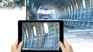
... information wastes precious time. Go paperless with FARO Visual Inspect Augmented Reality (AR). This powerful visual inspection software lets you access CAD data on a mobile device so you can compare it to an actual product ...
FARO EUROPE
... tools. Product Overview Discover Defect Software, previously known as Discover Enterprise Software, is a software solution that readily integrates into the production environment. ...
From creating part measurement routines to operating an OGP system in a production work environment, Measure-X® metrology software offers power without intimidation. Measure-X® features a full set of ...
Optical Gaging Products
The AutomationManager is a software platform that enables the automated and user-independent surface measurement and evaluation of micro-precision components or micro-structured surface details on large components. The ...
Bruker Alicona
... memory and optimization, always pushing the envelope. Unparalleled performance and unparalleled ease of use. The software architecture provides two key benefits: Import and process heavy CAD files. ...
Metrologic Group
O-QIS contains the required features to support the user in production or in the metrology lab in their quality evaluation and assessment tasks. The software package covers fields like standard statistical ...

... manufacturing environments. The FARO BuildIT Metrology Software product simplifies these processes with real-time guidance tools, advanced algorithms and easy-to-set-up automation. It’s the industry’s ...

... visualizations. The import of native CAD data allows you to work faster and more intuitively. System-independent Inspection Software for 3D Data Individual configuration and templates Fast evaluation of several ...
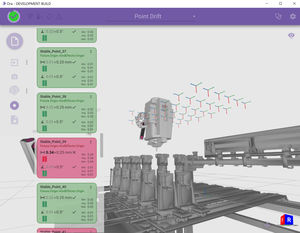
ORA is our software platform that powers our IONA Network, provides unique data analysis and connects seamlessly with the robot and factory systems. ORA analyses the physical cell set-up, robot movements and fixture ...
... control software solution to control tool or part dimensions, diagnose and prevent manufacturing and assembly issues, guide assembly building through real-time measurements, and oversee the quality of assembled products ...
InnovMetric Software Inc.
Please specify:
Help us improve:
remaining