
{{product.productLabel}} {{product.model}}
{{#if product.featureValues}}{{product.productPrice.formattedPrice}} {{#if product.productPrice.priceType === "PRICE_RANGE" }} - {{product.productPrice.formattedPriceMax}} {{/if}}
{{#each product.specData:i}}
{{name}}: {{value}}
{{#i!=(product.specData.length-1)}}
{{/end}}
{{/each}}
{{{product.idpText}}}
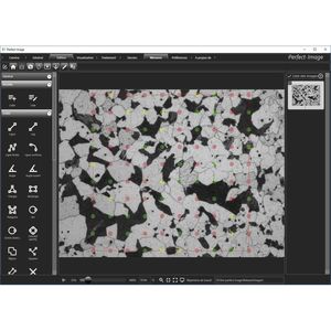
... The interface is clear, enabling the user to become familiar with the software very quickly. The toolbar can be completely customised, making it possible to configure the software very simply with the ...
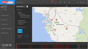
ETAP GIS Map automatically generates electrical one-line diagrams with the corresponding geographical maps of power generation, transmission, and distribution systems. Electrical system data is synchronized from GIS into ETAP thereby ...
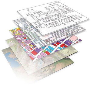
... relatively broad term that can refer to a number of different technologies and operations also called services such as: Cartography: the design and production of maps Mapping: the process of using maps delivered ...
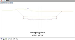
... Image you can easily georeference and distort images using control points, from their coordinates or using as a reference cartography of the CAD drawing itself.
Aplitop
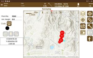
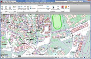
... The app has multiple options for surveying and stake out plots, terrains and linear works, using base maps as well as cartography and web map services.
Aplitop
... and stake out plots, terrains and linear works, using as base maps orthoimages, cartography or web map services. Cartography DXF or Shape files can be loaded as cartography. Also, it ...
Aplitop
Please specify:
Help us improve:
remaining