
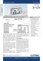
10-axis positioning system HG S-57652automaticsatellite

Add to favorites
Compare this product
Characteristics
- Number of axes
- 10-axis
- Features
- automatic
- Other characteristics
- satellite
Description
Positioning of Cranes using RTK DGNSS with Control Unit HG G-61430YD
Overview
RTG positioning/autosteering or container tracking with Global Navigation Satellite Systems (GNSS)
State of the art RTK DGNSS
Position accuracy better ±2 cm with 20 Hz update rate
Heading accuracy ~ 0.1° with 2 m baseline and 20 Hz
Up to 255 blocks for autosteering / container tracking
User friendly and comfortable web interface via Ethernet
all web browsers supported
all operating systems
remote usage possible
Basic Function
The system uses RTK DGNSS to calculate highly accurate positions (GNSS = Global Navigation Satellite System, e.g. GPS). DGNSS stands for Differential GNSS and means that a reference station uses its known position to calculate the current deviation of the GNSS signal. This difference value is then transmitted wirelessly to all rovers (usually cranes).
To make the position even more accurate Real Time Kinematic (RTK) is applied. Here the carrier phase of the satellite signal is evaluated (the system needs up to approx. 60 seconds after initial start up for ruling out ambiguities). RTK DGNSS gives an accuracy of about ±2 cm which enables Container Tracking and RTG Autosteering.
Container Tracking
Using the system RTGs can detect and wirelessly transmit the current position whenever they pick up or set down a container. The superordinate container management system can then check the position and store it, thus documenting the whereabouts of individual containers.
RTG Autosteering
Due to the high accuracy of the system it is possible to track a vehicle‘s movements.
Catalogs
HG S-57652ZD
2 Pages
Related Searches
*Prices are pre-tax. They exclude delivery charges and customs duties and do not include additional charges for installation or activation options. Prices are indicative only and may vary by country, with changes to the cost of raw materials and exchange rates.