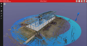
Database software Cyclone SURVEYqualityasset managementcreation

Add to favorites
Compare this product
Characteristics
- Function
- asset management, quality, engineering, creation, database, mapping
- Applications
- construction, office, foundation, surveying, alignment
- Type
- 3D
- Deployment mode
- cloud
Description
Leica Cyclone SURVEY combines high performance with a rich set of survey-specific tools for analysing laser scan data and converting the data into deliverables.
Cyclone SURVEY (a lower cost, survey-specific version of Leica Cyclone MODEL) boasts powerful visualisation & point cloud navigation plus a complete tool set for High-Definition Surveying (HDS™) applications in engineering, construction and asset management.
Cyclone SURVEY provides unmatched office productivity by automating many time-consuming tasks and even letting multiple users work on the same data sets simultaneously – thanks to Leica Cyclone’s Object/Database foundation. Finally, Cyclone SURVEY reflects the data quality & accuracy-consciousness advantages that users worldwide expect from Leica Geosystems.
Features and Benefits
Breakline generation from feature coded templates
SmartPicks and Points on Grid tools
Virtual Surveyor data collector emulation
Extract contours, cross-sections, profiles
TIN/Mesh creation, including grid option
Calculate volumes, areas, and clearances
Comprehensive set of import/export utilities
Direct import of Leica HDS and Leica Pegasus project data, including mobile trajectories and imagery
Direct import of DotProduct *.dp files
Batch import and auto image-to-scan alignment for iSTAR, Spheron, and Nodal Ninja external camera workflows
Advanced image-to-scan texture mapping options with complete HDR Tone Map Editor
Fly Mode for smooth, 3D fly-through navigation, including 3D mouse support
Catalogs
Exhibitions
Meet this supplier at the following exhibition(s):


Related Searches
- Automation software solution
- Management software solution
- Analysis software solution
- Windows software solution
- Leica CAD software
- Process software solution
- Control software solution
- Online software
- Real-time software solution
- 3D software solution
- Design software solution
- Measurement software
- Monitoring software solution
- Interface software
- Quality software
- Visualization software solution
- Development software solution
- Network software solution
- Engineering software
- Machine software
*Prices are pre-tax. They exclude delivery charges and customs duties and do not include additional charges for installation or activation options. Prices are indicative only and may vary by country, with changes to the cost of raw materials and exchange rates.


