
- Robotics - Automation - Industrial IT
- Industrial Software
- Metrology software
- Leica Microsystems GmbH
- Company
- Products
- Catalogs
- News & Trends
- Exhibitions
Metrology software Mapimagingindustrialfor production

Add to favorites
Compare this product
Characteristics
- Function
- metrology, imaging
- Applications
- industrial, for production, laboratory, for microscopes
- Type
- 3D
Description
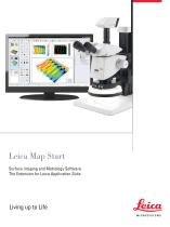
Leica Map Start is the entry level software package of the Leica Map series. It is used for viewing and analyzing surface geometry and surface texture from LAS Montage depthmap images.
Capabilities include 3D visualization of surfaces, characterization of basic surface features and calculation of surface texture parameters.
If you combine Leica Map with the highly intuitive desktop publishing environment, it is the perfect solution for measuring industrial surfaces made by Leica microscopes in laboratories, production facilities and research.
Key Features
Surface Imaging
Real time surface imaging using LAS Montage extended-focus images for easy detail identification
Metrology Standards and Methods
Surface characterization and analysis for compliance with the latest international metrology standards and methods
Interactive report
Interactive report creation easily customized to the needs of the laboratory
Optimal Usability
Exceptional ease of use and comprehensive online help makes you quickly productive
Catalogs
Leica Map
12 Pages


Leica LAS X Industry
4 Pages
Other Leica Microsystems GmbH products
Microscope Imaging Software


Related Searches
- Analysis software solution
- Leica Windows software
- 3D software solution
- Industrial software solution
- Quality software
- Inspection software
- Laboratory software
- Production software solution
- Metrology software
- Imaging software
- Quality control software solution
- Steel construction software
- Leica microscope software
- Microscopy software
*Prices are pre-tax. They exclude delivery charges and customs duties and do not include additional charges for installation or activation options. Prices are indicative only and may vary by country, with changes to the cost of raw materials and exchange rates.