

- Products
- LIDAR sensor module
- SkylandX


- Company
- Products
- Catalogs
- News & Trends
- Exhibitions
LIDAR sensor module C01

Add to favorites
Compare this product
Description
Overview
The C01 is a SLAM LiDAR designed for precise localization, mapping, measurement and obstacle avoidance. Its tighter laser spot and improved range consistency generate dense, low-noise point clouds at the hardware level, enabling sharper geometry capture and stable long-range mapping without algorithmic compensation.
Field Test Performance
Minimal Blind Zone
Optically and mechanically optimized to minimize blind zones for improved near-field detection and safer obstacle avoidance in cluttered environments.
Applications
Technical specifications
The C01 is a SLAM LiDAR designed for precise localization, mapping, measurement and obstacle avoidance. Its tighter laser spot and improved range consistency generate dense, low-noise point clouds at the hardware level, enabling sharper geometry capture and stable long-range mapping without algorithmic compensation.
Field Test Performance
- Higher repeatability: smaller laser spot and improved range precision reduce measurement noise and preserve true surface variation.
- Sharper edges and corners: clean transitions with accurate corner geometry, no rounding or trailing points.
- Long-range mapping stability: lower positional and attitude error over extended routes, maintaining map consistency even without loop closure.
Minimal Blind Zone
Optically and mechanically optimized to minimize blind zones for improved near-field detection and safer obstacle avoidance in cluttered environments.
Applications
- Autonomous forklifts
- Autonomous mobile robots (AMRs)
- Service robots
- Humanoid robots
- Quadruped robots
- Handheld scanners and spatial data collection platforms
Technical specifications
- Purpose: SLAM LiDAR for localization, mapping, measurement and obstacle avoidance
- Point cloud: dense, low-noise point clouds produced at hardware level without algorithmic compensation
- Optics: tighter laser spot for improved detail and repeatability
- Measurement consistency: higher range precision to cut noise and preserve real surface variation
- Geometry fidelity: maintains sharp edges and true corner geometry (no rounding or trailing points)
- Mapping stability: lower positional and attitude error over extended routes; improved long-range mapping stability even without loop closure
- Blind zone: minimal blind zone design to enhance near-field sensing
- Compatibility: plug-and-play with mainstream open-source SLAM algorithms; built for AMRs and spatial data collection workflows
- Primary use cases: robotic perception, autonomous navigation, spatial surveying, industrial inspection, handheld scanning
Catalogs
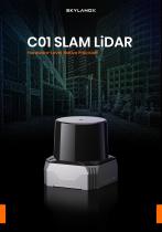
SKYLANDX_C01_SLAM LIDAR
5 Pages
*Prices are pre-tax. They exclude delivery charges and customs duties and do not include additional charges for installation or activation options. Prices are indicative only and may vary by country, with changes to the cost of raw materials and exchange rates.
About DirectIndustry
DirectIndustry is a marketplace that offers B2B players a complete experience, from product sourcing to purchase. DirectIndustry is an entity of VirtualExpo Group.
Are you a buyer?
Are you a supplier?