- Products
- Catalogs
- News & Trends
- Exhibitions
Measurement software GeoProCADdesignprocess


Add to favorites
Compare this product
Characteristics
- Function
- measurement, CAD, design
- Applications
- process, instrument, office
- Type
- 3D
Description
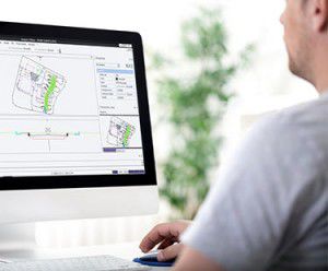
Introducing the quickest and easiest way to process and use field measurements in the office.
Quickly cleanup and process common field data entry errors. Items such as height of instrument, a forgotten backsight, or erroneous point code entry can be easily corrected and then results processed.
Process field measurement data from a variety of field sensors in the same job file.
By combining data from multiple sensors, you get a more complete view of the project than you would having separate static files from each sensor.
Features:
Process raw data from field measurements
Work with total station, digital level, and GNSS receiver data
GNSS post processing
3D CAD view (optional module)
Road design tools (optional module)
Catalogs
GRX3
4 Pages
*Prices are pre-tax. They exclude delivery charges and customs duties and do not include additional charges for installation or activation options. Prices are indicative only and may vary by country, with changes to the cost of raw materials and exchange rates.


