- Robotics - Automation - Industrial IT
- Industrial Software
- Control software
- Zoller + Fröhlich Laser Scanner
- Products
- Catalogs
- News & Trends
- Exhibitions
Mapping software SynCaT®calibrationcontrolpositioning

Add to favorites
Compare this product
Characteristics
- Function
- calibration, control, mapping, positioning, synchronization, translation
- Applications
- scanner
- Type
- 3D
- Deployment mode
- cloud
Description
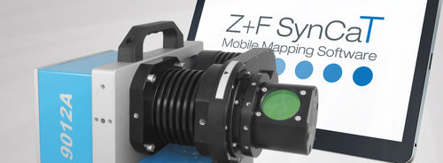
With the software Z+F SynCaT®, Zoller+Fröhlich creates a connection between the Z+F PROFILER® 9012 and external positioning and navigation systems. SynCaT stands for synchronization, calibration and transformation - also representing the main tasks of the software. Z+F SynCat® includes all the features below:
Calibration: Processing of calibration parameters due to different system integrations (translation, rotation offsets between the coordinate systems of the navigation-unit (trajectory) and the Z+F PROFILER® 9012 laser scanner)
Synchronization: Synchronize Z+F PROFILER® 9012 laser scanner data with trajectory data and generate 3D point cloud files
Transformation: Transform 3D point cloud data to different local coordinate systems and apply different local/global height correction models (geoid correction files)
Correction: Individual offset estimation referring to predefined ground control points (GCP’s)
Z+F SynCaT® is a modular structured mobile mapping software. The modularization allows to combine the software package specifically for the customer needs.
Other Zoller + Fröhlich Laser Scanner products
Laserscanning software
Related Searches
- Automation software solution
- Windows software solution
- Control software solution
- Online software
- 3D software solution
- Measurement software
- Visualization software solution
- 2D software
- Editing software
- Calibration software
- Color software
- Mapping software
- Office software
- Data transfer software solution
- Positioning software
- Viewer software
- Scanner software
- Synchronization software
- Digital filter software
- Translation software
*Prices are pre-tax. They exclude delivery charges and customs duties and do not include additional charges for installation or activation options. Prices are indicative only and may vary by country, with changes to the cost of raw materials and exchange rates.


