
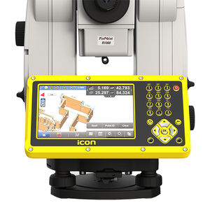
{{product.productLabel}} {{product.model}}
{{#if product.featureValues}}{{product.productPrice.formattedPrice}} {{#if product.productPrice.priceType === "PRICE_RANGE" }} - {{product.productPrice.formattedPriceMax}} {{/if}}
{{#each product.specData:i}}
{{name}}: {{value}}
{{#i!=(product.specData.length-1)}}
{{/end}}
{{/each}}
{{{product.idpText}}}

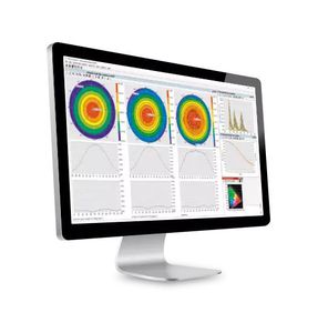
CHCNAV Precision Positioning Service Software (CPS) is an advanced server-based software solution package to control and manage regional and nationwide GNSS CORS and RTK networks. CPS ...
... build construction software provides versatility and flexibility for field crews to conduct layout, as-built and verification tasks on projects. Improve speed, performance and accuracy with just one custom built construction ...

... machine control and site positioning systems. Avoid time-consuming rework, hand off data seamlessly across a project and know everyone has the same plan. Your jobsite information can now flow seamlessly through all ...
Trimble Navigation - Construction Division

... support software for Motion system from system designing, programming, servo adjustment, and to maintenance. System Settings With the highly graphical nature of the system settings screen, setting up servo amplifiers ...
... support software for Motion system from system designing, programming, servo adjustment, and to maintenance. System Settings With the highly graphical nature of the system settings screen, setting up servo amplifiers ...
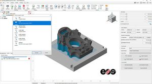
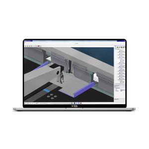
... parametric supports. Why use Autodesk Netfabb? Bring products to market faster Simplify print preparation steps like positioning, support generation, and slicing. Reduce build failures Predict and compensate ...

Galil's PVT Software is a software tool that is used to convert Galil Contour Data points to Galil Position Velocity and Time (PVT) profiles. PVT mode allows arbitrary motion profiles to be defined by ...
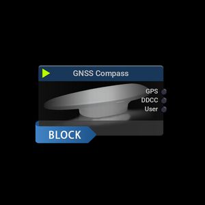
Allows the usage of an external dual GNSS satellite navigation system for position, direction and tilt information.
Allows the usage of an external positioning system device in RTSA-Suite PRO.
... -time positioning is not necessary. It can also be used to improve GPS/GNSS data when the real-time base station link is unstable or has malfunctioned. Septentrio PP-SDK offers you the possibility to achieve reliable ...
Septentrio

... enhances data visualisation to take utility detection and mapping to the next level. The uViewer software is designed to operate on site with any GNSS positioning systems as well as maximise user experience ...
... office software • Do quality control of GNSS data before export to Survey or GIS software CARLSON SURVEYGNSS AT A GLANCE • Supports differential post-processing of RINEX GNSS observations in static, ...
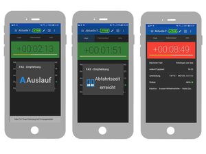
The driver assistance system (FAS) from INTERAUTOMATION and INAVET helps you to meet the high demands you are facing. This concerns both ecological aspects, such as the reduction of CO2 emissions and the efficient use of resources in ...

... the help of real-time analytics Optimization of production based on results of step two Location Intelligence is a software application for locating systems, such as SIMATIC RTLS. The mobile objects of interest ...
Master BendCam programming system is a user-friendly, integrated tool for managing Prima Power Panel Benders through interactive graphical techniques in an efficient way. It is designed to meed maximum positive impact on manufacturing ...
PRIMA POWER
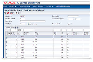
Oracle’s JD Edwards software meets the demands for a modern and simplified user experience. Our purpose-built applications are aligned to how your users work. Integrated with digital technologies, our innovative approach ...
... installed in the forest machine. The PONSSE Opti Map 2 program, available as an additional feature, is a versatile map positioning program for forest machines, which supports the comprehensive Opti 4G information system.
PONSSE

... Bevel cutting With Libellula.CUT you can program all the cutting machines: laser, plasma, oxycutting, water jet. The software is designed to allow you to achieve the best cutting results, saving material, reducing ...
Libellula S.r.l
... Global Positioning System) Utility replicates the physical GPS data to multiple COM ports to help ensure operational efficiency. Because you need to ensure your industry-specific application runs seamlessly Our ...
DMS software – Automated system control and comprehensive data analysis A DMS all-in-one solution comprising of positioning system, accessories, control and analysis tools allows for complete and fully ...

... information fully automatically. 4 - DTG Printing Automatically loading print print files of orders, controlling positioning via EPS and saving machine profiles per item and per colour is possible with Smake. Maximum ...

... Professional functions for editing figures and texts Shading, user-definable shading patterns Automatic functions for positioning and alignment Contour sketching and interactive changing Numeric input ...
... the Product Overview. Software: Please access our Distributor's Corner to download the instruction documents. Field data collection software compatibility FieldGenius from MicroSurvey ...
GrafNav GNSS Post-Processing Software GrafNav post-processing software is a powerful, highly configurable processing engine that allows for the best possible static or kinematic GNSS accuracy using ...
NovAtel
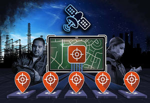
... tracking feature. Track your bins in both metropolitan and rural areas. Remotely monitor container locations thanks to triple positioning technology that uses Wi-Fi access points, cell towers, and GPS/Beidou satellites. Asset ...
... Programming can be carried out without having to dispense with the convenience of offline software. The software has been expanded to include a warpage correction module. This makes it possible to ...
Please specify:
Help us improve:
remaining