
Mapping software Mapping Toolbox™geotechnical data analysisvisualization

Add to favorites
Compare this product
Characteristics
- Function
- mapping, geotechnical data analysis, visualization
Description
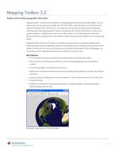
Mapping Toolbox™ provides algorithms and functions for transforming geographic data and creating map displays. You can visualize your data in a geographic context, build map displays from more than 60 map projections, and transform data from a variety of sources into a consistent geographic coordinate system.
Mapping Toolbox supports a complete workflow for managing geographic data. You can import vector and raster data from a wide range of file formats and web map servers. The toolbox lets you process and customize data using trimming, interpolation, resampling, coordinate transformations, and other techniques. Data can be combined with base map layers from multiple sources in a single map display. You can export data in file formats such as shapefile, GeoTIFF, and KML.
Catalogs
Mapping Toolbox 3.2
7 Pages
Other The MathWorks products
MATLAB® Product Family


Related Searches
- Automation software solution
- Management software solution
- Analysis software solution
- Process software solution
- Windows software solution
- Real-time software solution
- Computer-aided design software
- Online software
- Control software solution
- Design software solution
- 3D software solution
- Measurement software
- Visualization software solution
- Simulation software solution
- Automated software
- Programming software
- Network software solution
- Reporting software solution
- Engineering software
- Machine software
*Prices are pre-tax. They exclude delivery charges and customs duties and do not include additional charges for installation or activation options. Prices are indicative only and may vary by country, with changes to the cost of raw materials and exchange rates.