- Company
- Products
- Catalogs
- News & Trends
- Exhibitions
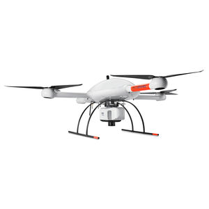
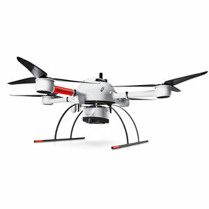
Quadcopter drone mdLiDAR3000DLinspectionmappingfor heavy loads


Add to favorites
Compare this product
Characteristics
- Type
- quadcopter
- Applications
- mapping, inspection, for agricultural applications, for heavy loads
Description
The newest LiDAR system from Microdrones is revolutionary. We perfectly integrated our heavy lifting md4-3000 drone with a Riegl miniVUX-1DL and a SONY RX1R II camera for rapidly producing colorized pointclouds.
Who Should Consider This System:
As you’ve come to expect, Microdrones provides you with the full solution: Plan, Fly, Process, Visualize. Only Bigger.
This is a serious machine for serious geomatics professionals in the construction, land development, engineering, surveying and research trades. It’s field tough and ready to work with you on the following tasks:
Corridor mapping
Mining (volume calculation)
Construction site monitoring
Environmental changes (time series)
Forestry
Contour mapping
Leveling/Excavation
Archaeology and cultural heritage
Highway construction
THE ULTIMATE UNMANNED AERIAL LiDAR SOLUTION FROM MICRODRONES
By combining our robust and field proven md4-3000 airframe, with a highly precise and accurate Riegl miniVUX‑1DL payload, you can capture ultra dense LiDAR data quickly and safely in the field, and then turn it into a 3D colorized pointcloud back at the office or on your laptop.
Catalogs
No catalogs are available for this product.
See all of Microdrones‘s catalogs*Prices are pre-tax. They exclude delivery charges and customs duties and do not include additional charges for installation or activation options. Prices are indicative only and may vary by country, with changes to the cost of raw materials and exchange rates.


