- Company
- Products
- Catalogs
- News & Trends
- Exhibitions
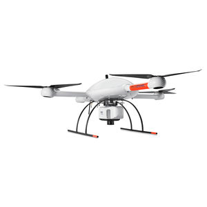
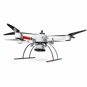
Quadcopter drone mdLiDAR1000LRmappingfor agricultural applications

Add to favorites
Compare this product
Characteristics
- Type
- quadcopter
- Applications
- mapping, for agricultural applications
Description
mdLiDAR1000LR: means longer range. You'll cover more ground from above. This translates to more efficiency than ever - the survey equipment, software, workflow, training and support that you need to be productive in the field.
QUICK SPECS
-System Accuracy
-LiDAR Pointcloud
-4 cm RMSE
-Photogrammetry:
-Horizontal: 2 – 3 pixels
-Vertical: 3 – 5 pixels
-LiDAR Sensor: Velodyne Ultra-PUCK VLP-32
-Camera Sensor: Microdrones CMOS APS-C 26MP (23.5mm x 15.6mm)
-Georeferencing: APX-15 UAV
LONGER RANGE LiDAR & 26MP CAMERA ALL IN ONE, TO COVER MORE GROUND
mdLiDAR1000LR means longer range. You'll cover more ground from above. This translates to more efficiency than ever - the survey equipment, software, workflow, training and support that you need to be productive in the field - with convenient mdaaS plans.
Who Should Consider This System:
Professionals responsible for geospatial data collection should consider mdLiDAR1000LR to support the following tasks.
Digital Twin Creation and Maintenance
Corridor mapping
Mining (volume calculation)
Construction site monitoring
Environmental changes (time series)
Forestry
Contour mapping
Planning, Leveling, Excavation
Archaeology and cultural heritage
Highway construction
Precision Agriculture
Catalogs
PUTTING MICRODRONES TO WORK FOR YOU.
133 Pages
*Prices are pre-tax. They exclude delivery charges and customs duties and do not include additional charges for installation or activation options. Prices are indicative only and may vary by country, with changes to the cost of raw materials and exchange rates.


