
{{product.productLabel}} {{product.model}}
{{#if product.featureValues}}{{product.productPrice.formattedPrice}} {{#if product.productPrice.priceType === "PRICE_RANGE" }} - {{product.productPrice.formattedPriceMax}} {{/if}}
{{#each product.specData:i}}
{{name}}: {{value}}
{{#i!=(product.specData.length-1)}}
{{/end}}
{{/each}}
{{{product.idpText}}}

... The APACHE 4 is an Unmanned Surface Vehicle ( USV) that supports a wide variety of Acoustic Doppler Current Profiler (ADCP) systems available on the market. It offers an unmanned operation solution with a shallow draft, ...
CHC Navigation | CHCNAV

... The APACHE 3 Pro is a compact, professional unmanned surface vehicle ( USV) designed for autonomous bathymetric surveys in shallow waters. Its double-layer carbon fiber hull provides exceptional impact ...
CHC Navigation | CHCNAV
Speed: 6 m/s
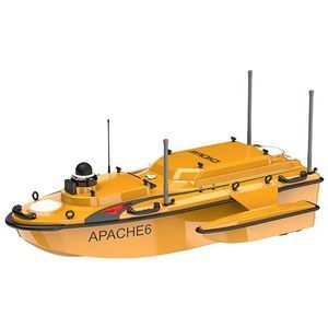
... The CHCNAV APACHE 6 is an autonomous unmanned surface vehicle ( USV) for high-resolution 3D bathymetric surveys, underwater object localization and offshore construction. It combines a stable triple-hull ...
CHC Navigation | CHCNAV
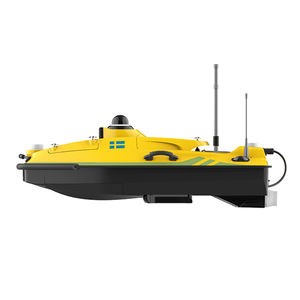
... The HydroBoat 1200MB is SatLab's latest multibeam USV solution, combining proven unmanned vessel technology with the HydroBeam M2 MBES (Multibeam Echo Sounder). Compact and easy to deploy, it delivers efficient, accurate hydrographic ...
SatLab Geosolutions AB
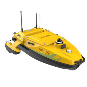
... office. ● Intuitive Android Control Simplify operations with the user-riendly SLHydro USV software, featuring route planning, boat control, and status monitoring features. ● Uncompromising Safety Navigate with ...
SatLab Geosolutions AB
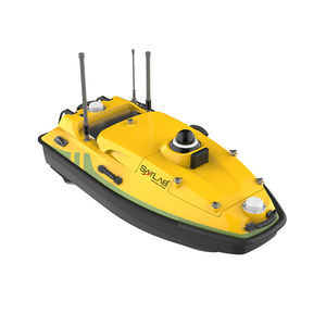
... is designed especially for integrating with varied water measurement devices for hydrographic surveys and environmental monitoring. Its lightweight design and enhanced maneuverability facilitate operational flexibility in different instrument ...
SatLab Geosolutions AB

... and qualitative monitoring of available water resources issues reveal the need for accurate bathymetric, hydro-sedimentary and physico-chemical measurements. The techniques currently used for bathymetric ...
Robotics Industry

Speed: 6 m/s
Endurance: 5 h
Weight: 25 kg
... The iBoat BS12 emerges as the embodiment of sophistication and simplicity, expertly designed for effortless operation across a multitude of applications. Engineered with the latest CFD technology and boasting a sleek carbon fiber and Kevlar hull, the ...
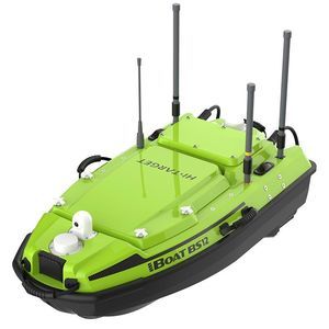
Speed: 0 m/s - 6.5 m/s
Endurance: 240 min
Weight: 29 kg
Overview iBoat BS12 Gen2 is a next‑generation compact multifunctional marine surveying platform from Hi‑Target. It supports professional payloads such as the iBeam 8140S multibeam echosounder, ADCP, side‑scan sonar and water‑quality sensors. Designed ...
Speed: 6, 10 m/s
Endurance: 6 h
Weight: 15 kg
... ul>
Applications
- Hydrographic surveys and bathymetric mapping
- Seabed mapping, pipeline and structure inspection
- Environmental monitoring and shallow‑water survey campaigns
Logistics ...
Speed: 0 m/s - 7 m/s
Endurance: 180 min - 420 min
Weight: 7 kg - 30 kg
... Surface Vessel is a compact, highly integrated autonomous platform for hydrographic surveying and multi-parameter water monitoring. It integrates high-precision GNSS positioning, depth sounding and vessel control software with an expandable ...
the best suppliers