
{{product.productLabel}} {{product.model}}
{{#if product.featureValues}}{{product.productPrice.formattedPrice}} {{#if product.productPrice.priceType === "PRICE_RANGE" }} - {{product.productPrice.formattedPriceMax}} {{/if}}
{{#each product.specData:i}}
{{name}}: {{value}}
{{#i!=(product.specData.length-1)}}
{{/end}}
{{/each}}
{{{product.idpText}}}
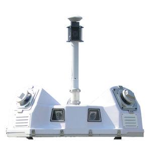
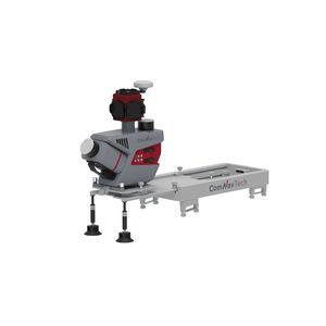
... MMS is a high-precision mobile mapping system designed for vehicle-mounted applications. Its advanced LiDAR and AI-powered algorithms capture accurate 3D spatial data while streamlining field-to-office workflows. The ...
... quality Configurable system parameters manage data volume LMS enables efficient and robust QA/QC LMS workflow automates high-volume processing Automated boresighting simplifies operations Ladybug 360° camera ...
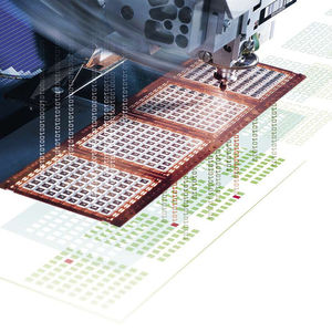
... That’s where Substrate Mapping E142 comes into play. E142 applies a virtual map like representation of the physical world to a lot of common substrate such as e.g. wafers, strips and trays. Besi Switzerland did implement Strip Mapping ...
... Trusted, field-proven mobile mapping Capture immersive scans and images at highway speeds. Benefits and performance Leverage your large-scale mobile mapping projects with the Trimble MX90, which delivers unmatched ...
Trimble

... constructions such buildings, increases the flexibility and efficiency of your investment. Just by walking, this multidisciplinary system allows you to digitise pedestrianised city centres, the progress of construction sites, building ...
Leica Geosystems
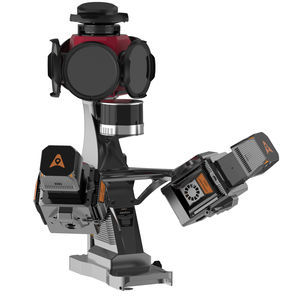
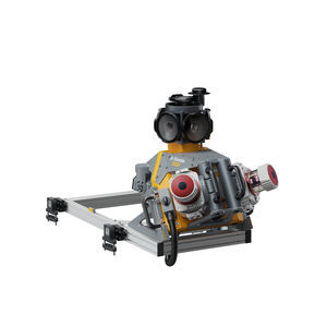
... ML300 is a mobile laser scanning (MLS) system designed for efficient 3D mapping of roads and surrounding environments. It combines two LiDAR sensors (one tilted at 30° and one horizontal) with a Ladybug5+ panoramic camera ...
... the support of the Realm Enablement Suite. The Integrity 150 is the industry’s first solar-powered tracking and monitoring device with an integrated edge application development platform. Featuring Globalstar’s industry-leading low-power ...

... ● HD large 5inch touch screen which fulfill the Android users needs● Double OS options: WEH or Android● Android version supports multiple languages switch● Quad-Core 1.3GHz processor● Micro-USB port and OTG function● Being equipped with laser centering ...
South Surveying & Mapping Instrument Co., Ltd

... GEOSPATIAL PRODUCTIVITY MADE SIMPLE AND AFFORDABLE. Microdrones is making it easy for professionals to get started with everything needed to use drones for complex surveying work. WHAT IS MDAAS? MICRODRONES AS A SERVICE mdaaS empowers customers ...
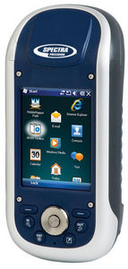
... MobileMapper® 120 is the newest generation of handheld mapping devices from Spectra Precision. Designed for GIS data collection and mapping, the MobileMapper 120 integrates an open operating system, ...
Spectra Precision

Sometimes you need to quickly document the floor plan of a building, either for public safety needs or as the basis for renovation or expansion. The FARO ScanPlan 2D Handheld Mapper makes it easy — just attach your phone and start scanning. Lightweight ...
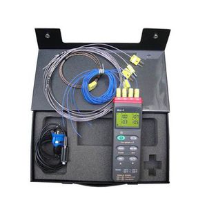
... furnace temperature tracker is a high precision, high stability test records of furnace temperature products, filled the domestic blank in the field of temperature acquisition, the system also equipped with a powerful ...
the best suppliers