
{{product.productLabel}} {{product.model}}
{{#if product.featureValues}}{{product.productPrice.formattedPrice}} {{#if product.productPrice.priceType === "PRICE_RANGE" }} - {{product.productPrice.formattedPriceMax}} {{/if}}
{{#each product.specData:i}}
{{name}}: {{value}}
{{#i!=(product.specData.length-1)}}
{{/end}}
{{/each}}
{{{product.idpText}}}

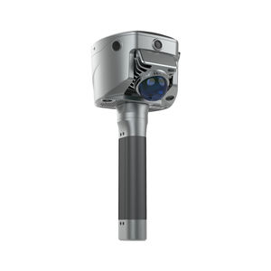
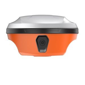
... manual initialization, and simplifying surveying operations in the field. With its advanced features and cutting-edge technology, the i93 is the ideal solution for professionals seeking to complete surveying, engineering, ...
CHC Navigation | CHCNAV

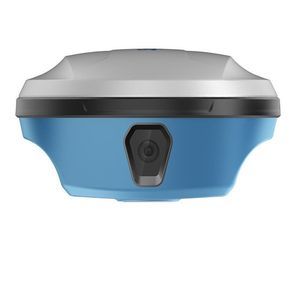
... OVERVIEW __ The i83 GNSS receiver is more than a universal 1408-channel multi-band IMU-RTK GNSS receiver, it is the perfect GNSS RTK survey tool that any surveying, construction, or mapping professional ...
CHC Navigation | CHCNAV

... The i73+ GNSS is an extremely compact, powerful, and versatile GNSS receiver with an integrated UHF Tx/ Rx modem that can be used either as a base station or as a rover. Powered by CHCNAV iStar technology that optimally tracks satellite ...
CHC Navigation | CHCNAV
... technologies to deliver centimeter-level accuracy in both open environments and GNSS-denied areas, enabling efficient, reliable surveying anywhere. Key Features: 1. Measure Anywhere, Even without Signal Seamlessly capture data in GNSS-denied ...
Hi-Target Surveying Instrument Co.,Ltd

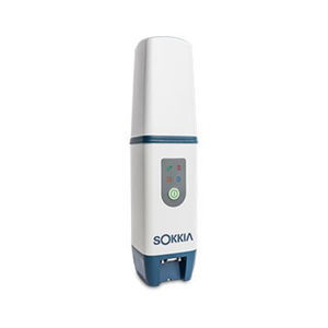
Equipped with an upgraded high-definition starlight camera, V500 brings out an excellent visual stakeout experience in low-light conditions. The compact and lightweight design,24 Hours Ultra-Long battery life make V500 a feasible and portable choice for ...
Hi-Target Surveying Instrument Co.,Ltd

... professional dual cameras, vRTK is Hi-Target’s first lightweight and innovative visual RTK receiver product, which not only enables non-contact image surveying, breaking through the objective constraints of previous ...
Hi-Target Surveying Instrument Co.,Ltd
... and never-seen-before performance in tree canopy situations. The GCX3 may look similar to the previous model but both the receiver board and the antenna element have been updated. Try it and see the difference. The GCX3 is the ideal ...
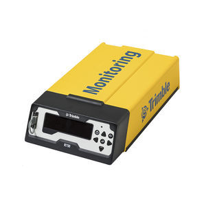
... High frequency, high accuracy monitoring. The Trimble® R750 MON Model 2 GNSS receiver incorporates the latest industry-leading positioning technology from Trimble, along with modern communications capabilities, in a rugged form factor ...

... Hexagon group, GeoMax can guarantee its solutions work when you do. Technology that makes your life easier The GNSS receiver's tilt capability lets you measure inaccessible points and speed up your work. You no longer need to spend ...
GeoMax
... Product overview
- The Q700-ARSync is an IMU-RTK GNSS receiver delivering centimeter-level positioning combined with an integrated inertial sensor suite for reliable dynamic performance.
Key features
SpatiX
...
Applications
- Surveying and mapping,
SpatiX
... Product overview
- Product title: X3-DualVision GeoSync RTK receiver
- Brand: SpatiX
- Model: X3-DualVision
- Primary language of source content: English
Key features
- RTK
SpatiX
... the image to obtain its 3D coordinates. Achieve 2–5 cm accuracy within 15 meters using the Satsurv app. 2. Boundaryless Surveying with SLAM-Fix Tech: SL9 smartly switches between RTK and SLAM. Get reliable coordinates even under bridges, ...
SatLab Geosolutions AB

... 1. Powerful Satellite Tracking and Anti-jamming Capabilities SatLab's unique design and self-developed antenna promise a stable and efficient operation. A highly integrated motherboard chip with low power consumption, supporting up to 1408 channels, ...
SatLab Geosolutions AB

... of windows and the roofs. Measuring other points without revisiting the site. 3D modelling of cities through surveying. Integrated surveying projects for premises. Channel: 1408 Tilt Survey Accuracy: 8mm+0.7mm/°tilt Image ...
SatLab Geosolutions AB

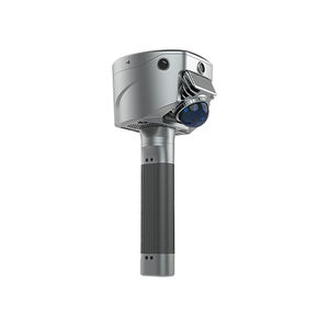
... Jupiter Laser RTK is a high-end GNSS receiver that integrates cutting-edge GNSS, IMU, Laser and dual-camera technologies. Building on the advanced laser technology of the Universe Series, Jupiter also incorporates SinoGNSS’s latest visual ...
ComNav Technology Ltd.

... The Mars Laser RTK is an innovative GNSS receiver that integrates the most advanced GNSS, IMU, and laser technologies. It combines GNSS receiver and laser technology, shattering usual constraints in land survey, construction, ...
ComNav Technology Ltd.

... GNSS receiver that enables rodless surveying with a millimeter laser, breaking the usual constraints. Plus the 380g weight minimizes users’ fatigue and the handheld design facilitates operation. Furthermore, this is ...
ComNav Technology Ltd.
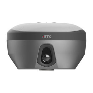
... professional dual cameras, vRTK is Hi-Target’s first lightweight and innovative visual RTK receiver product, which not only enables non-contact image surveying, breaking through the objective constraints of previous ...
Novatest

... can quickly check and set the receiver status for easier fieldwork. REVOLUTIONARY TILT SURVEY WITH BUILT-IN IMU Customers benefit from calibration-free for tilt surveys without centering. Once you reach the surveying ...
Novatest
... iRTK4 GNSS RTK System is a full-featured intelligent receiver, equipped with a new generation full-frequency integrated antenna and advanced multi-channel technology that allows for accurate and reliable results. IMU GNSS RTK Immediately ...
Novatest
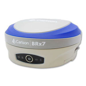
... The BRx7 GNSS receiver with SurvCE/SurvPC delivers a modern and flexible GNSS RTK product for precision surveys, with an intuitive and familiar application software. The lightweight BRx7 receiver may be used as a Rover, ...
... obstructed, or the receiver itself is tilted. Base and Rover Work in RTK with VRS or a single baseline CORS network. You can also connect another GNSS receiver as an NTRIP base using Emlid NTRIP Caster. Compatibility Any ...
EMLID

... The world’s largest, professionally-run RTK corrections network Get unmatched coverage, accuracy, and security. True RTK meets even your most demanding requirements for precision and convergence. Virtual RTK gives you consistent coverage and value ...
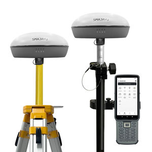
... and Portable: Designed to be compact and lightweight, this surveying tools are easy to carry in the field, enhancing mobility and efficiency for surveying professionals. The SMA20 RTK GNSS receiver supports ...
SMAJAYU(SHENZHEN) CO.,LTD

... Data link with Full HD Video System for SATPRO Long Range up to 150Km (LOS) Full HD long-range professional video up to 150Km. Specifically designed for the SATPRO tracker antenna. Prepared for all types of vehicles: UAV, Drone, Helicopter, ...
Digital Micro Devices S.L
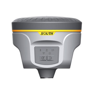
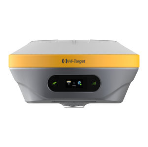
... ●Light weight and small size ●Linux platform ●E-bubble ●Tilt survey ●Intelligent storage technology ●Intelligent power supply technology (Optional) ●Radio Router ●Web UI management platform ●iVoice intelligent ...
South Surveying & Mapping Instrument Co., Ltd
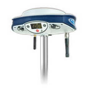
... 800 rover and rover/base system, with its 120 channels, offers L1/L2/L5 GPS+GLONASS+GALILEO field-proven technologies for surveying and geodesy. This is a powerful RTK survey solution delivering precise GNSS positioning in a smart, rugged, ...
Spectra Precision
the best suppliers