- Building - Construction
- Construction tool
- GreenValley International
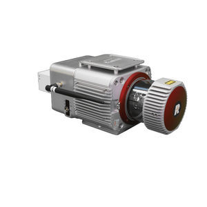
Mapping system LiAir 250


Add to favorites
Compare this product
Description
an generate up to 5 data points per laser pulse from its Riegl miniVUX-1 sensor. That, plus its 250 meter range, make it a well-qualified choice for mapping the terrain beneath forest canopies.
Overview
LiAir 250 is GreenValley International's flagship UAV LiDAR system designed to meet survey-grade project requirements. It is equipped with a highly precise navigation system, and can generate point cloud data with an absolute vertical accuracy of 3 cm. Together with its capability of a 250 m range measurement and recording up to 5 returns per pulse, LiAir 250 is an ideal choice for applications like mapping terrain features beneath the forest canopy, extracting forest structure parameters from individual tree level to forest stand level, inspecting power line corridor, managing and inspecting asset, and so on. Moreover, LiAIr 250 also provides an option to be equipped with a high-definition digital camera, which can be used to generate photogrammetry products as well as true color 3D point clouds
Simple Operation
One-button process data collection, one-button take-off and landing automatically execute the route.
Real-time Monitoring
The operation process supports real-time measurement of ground object coordinates, distance and elevation, and supports the rapid response to emergency rescue.
Real-time Measurement
The operation process supports real-time measurement of ground object coordinates, distance and elevation, and supports the rapid response to emergency rescue.
VIDEO
Catalogs
LiAir 250
1 Pages
Related Searches
*Prices are pre-tax. They exclude delivery charges and customs duties and do not include additional charges for installation or activation options. Prices are indicative only and may vary by country, with changes to the cost of raw materials and exchange rates.


