
{{product.productLabel}} {{product.model}}
{{#if product.featureValues}}{{product.productPrice.formattedPrice}} {{#if product.productPrice.priceType === "PRICE_RANGE" }} - {{product.productPrice.formattedPriceMax}} {{/if}}
{{#each product.specData:i}}
{{name}}: {{value}}
{{#i!=(product.specData.length-1)}}
{{/end}}
{{/each}}
{{{product.idpText}}}

... the creation of mesh models by generating high-quality point clouds. Powered by a 45 MP orthographic internal camera, the system provides high-resolution image mapping textures for efficient 3D model reconstruction with realistic point ...

... processing tools open the door to a full range of processing options from datum shifts to full waveform display and editing to the creation of enhanced information products in a wide variety of formats. Features & ...
Optech
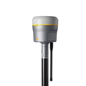
... The Trimble® R980 GNSS system unlocks peak accuracy and productivity for land surveyors with proven GNSS performance. Overcoming challenging GNSS conditions and excelling in remote locations, the R980 is ready to work wherever the job ...
Trimble

... R26 Surveying System Rover+Base R26 integrated Beidou/GNSS receiver is a built-in large-capacity battery, large-capacity memory card, integrated multi-functional high-precision inertial navigation RTK receiver independently ...
SMAJAYU(SHENZHEN) CO.,LTD

... ●Outstanding Waterproof Capability ●Extremely Rugged Housing ●Advanced OLED Screen ●Inbuilt Radio Transmitter ●Inbuilt Double Batteries ●Inbuilt GPRS/GSM Module New S86 Adhering to the excellent quality and creating the high-end brand, ...
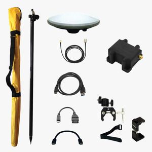
... With the RTK Calibrated Surveyor Kit you will have everything you need to start your surveying tasks with RTK and centimeter level accuracy. You can use your preferred Android app to power and connect to the simpleRTK2Blite receiver ...
ArduSimple
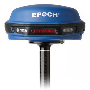
... software * Support for all GNSS data with Spectra Precision Survey Office software The Spectra Precision® EPOCH® 50 GNSS system, with its 220 channels, makes effective use of the GPS L1/L2/L2C/L5 and GLONASS L1/L2 signals for outstanding ...
Spectra Precision

... to 12kts Automated profiler deployment and recovery Wireless bluetooth data transfer Lightweight and portable with fast mobilization on a varietyof vessels Over 500m profiling depth capability at 5kts The rapidCAST™ system ...
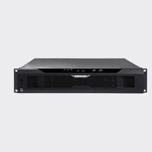
... High-performance, High-capacity • Up to 5000 channel per unit • Max. 640Mbps incoming bandwidout • Max. 640Mbps output bandwidout • Up to 300 users access simultaneously • 8-level cascade • 32 devices stack per level High reliability • Embedded ...
the best suppliers