
{{product.productLabel}} {{product.model}}
{{#if product.featureValues}}{{product.productPrice.formattedPrice}} {{#if product.productPrice.priceType === "PRICE_RANGE" }} - {{product.productPrice.formattedPriceMax}} {{/if}}
{{#each product.specData:i}}
{{name}}: {{value}}
{{#i!=(product.specData.length-1)}}
{{/end}}
{{/each}}
{{{product.idpText}}}
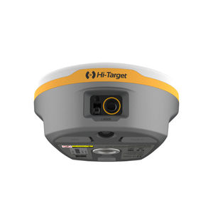
... Overview
Hi-Target V600L Laser
RTK is an integrated
surveying rover that combines non-contact laser measurement, a high-performance multi-constellation GNSS engine and an automotive-grade IMU. Designed for field ...

... R26 Surveying System Rover+Base R26 integrated Beidou/GNSS receiver is a built-in large-capacity battery, large-capacity memory card, integrated multi-functional high-precision inertial navigation RTK ...
SMAJAYU(SHENZHEN) CO.,LTD

... full-frequency antenna, and multiple frequency points in the whole system High-precision positioning and orientation boards, Bluetooth, inertial navigation, radio and other modules. GNSS Surveying System: √Built-in ...
SMAJAYU(SHENZHEN) CO.,LTD
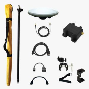
... With the RTK Calibrated Surveyor Kit you will have everything you need to start your surveying tasks with RTK and centimeter level accuracy. You can use your preferred Android app to power and connect ...
ArduSimple
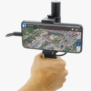
... With the RTK Handheld Surveyor Kit you will have everything you need to start your surveying tasks with RTK and centimetre level accuracy. You can use your preferred Android app to power and connect ...
ArduSimple
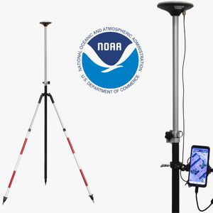
... With the RTK Base-Rover Calibrated Surveyor Kit you will have everything you need to start your surveying tasks with RTK and centimeter level accuracy. You can use your preferred Android app to power ...
ArduSimple
the best suppliers