
- Detection - Measurement
- Position, Speed and Acceleration Measurements
- High-accuracy inertial navigation system
- Oxford Technical Solutions Ltd.
- Company
- Products
- Catalogs
- News & Trends
- Exhibitions
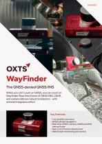
High-accuracy inertial navigation system WayFinderGNSSintegratedbox

Add to favorites
Compare this product
Characteristics
- Options
- GNSS, high-accuracy
- Mounting
- integrated, box
- Output signal
- CAN
Description
Localise anywhere, straight out of the box
WayFinder is ideal for anyone who needs accurate localisation data in challenging environments, including seamless transitions from open sky to GNSS-denied spaces.
Position accuracy - 0.01 m
Heading - 0.05 deg
Pitch/roll - 0.02 deg
GNSS-denied position accuracy - 0.03 m
Eliminate the complexity of GNSS-denied navigation
With WayFinder’s integrated GNSS, IMU, LiDAR and camera sensors – delivering precise, real-time localisation with minimal setup and effort. WayFinder is an advanced real-time sensor fusion platform that enables you to accurately navigate in any environment – even when GNSS signals are intermittent or completely blocked.
Ready to deploy out of the box,
WayFinder is the best solution for those who need a quick, easy-to-use navigation system for accurate, real-time localisation in challenging GNSS conditions.
/ Localisation data you can rely on, even in environments with patchy or no GNSS signal.
/ Seamlessly switch between GNSS and LiDAR aiding to transition between environments.
/ Two survey-grade, quad constellation GNSS receivers
/ OXTS latest IMU10 inertial measurement unit
/ Integrated LiDAR sensor and LiDAR Boost software
Our unique LiDAR Boost technology takes data from WayFinder’s integrated LiDAR scanner to provide accurate localisation data in challenging environments. LiDAR Boost is a set of advanced algorithms that use data from WayFinder’s integrated LiDAR to compensate for missing or erroneous GNSS updates in real time. It enables high-accuracy localisation in challenging GNSS conditions such as urban canyons, underground environments, or tunnels.
Catalogs
WayFinder Navigation System
2 Pages
Other Oxford Technical Solutions Ltd. products
Inertial Navigation System Hardware


Related Searches
- Inertial navigation unit
- GNSS INS
- High-accuracy inertial navigation system
- Lightweight inertial navigation system
- Miniature INS
- UAV INS
- INS with integrated GPS
- ITAR-free INS
- CAN INS
- OEM inertial navigation system
- Ethernet inertial navigation system
- Built-in inertial navigation system
- Serial inertial navigation system
- TTL inertial navigation system
*Prices are pre-tax. They exclude delivery charges and customs duties and do not include additional charges for installation or activation options. Prices are indicative only and may vary by country, with changes to the cost of raw materials and exchange rates.