
{{product.productLabel}} {{product.model}}
{{#if product.featureValues}}{{product.productPrice.formattedPrice}} {{#if product.productPrice.priceType === "PRICE_RANGE" }} - {{product.productPrice.formattedPriceMax}} {{/if}}
{{#each product.specData:i}}
{{name}}: {{value}}
{{#i!=(product.specData.length-1)}}
{{/end}}
{{/each}}
{{{product.idpText}}}
miniature inertial navigation systemXsens MTi-7
... Global Navigation Satellite System/ inertial navigation system) with advanced sensor fusion algorithms. Self-contained Self-contained with advanced sensor fusion algorithms, ...
Xsens

... br>Position
accuracy - 0.01 m
Heading - 0.05 deg
Pitch/roll - 0.02 deg
GNSS-denied position
accuracy - 0.03 m
Eliminate the complexity of GNSS-denied
navigation
With WayFinder’s ...
... Position
accuracy - 0.02 m
Heading - 0.1 deg
Pitch/roll - 0.05 deg
Velocity - 0.1 km/h
/ Cost-effective, reliable, real-time position and
navigation data
/ Two survey-grade, quad-constellation ...
... Ideal for georeferencing or precision control applications. Two survey-grade, quad GNSS antennas IMU10 inertial measurement unit As a board set inertial navigation system, ...
... Integrated
Navigation
System GI320
Product Introduction
GI320 adopts loose coupling integrated
navigation technology, deeply integrating an
IMU with an RTK solution ...
Wuxi Bewis Sensing Tecnology LLC
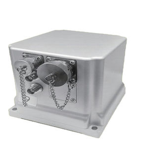
... The BW-GI1140 is a high-performance, high-precision fiber optic integrated navigation system developed by Bewis for the aerial mapping, unmanned aerial vehicles, sea-based and roadbed. ...
Wuxi Bewis Sensing Tecnology LLC
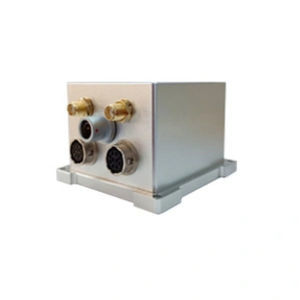
... The BW-GI940 is a high-performance, high-precision fiber optic integrated navigation system developed by Bewis for the aerial mapping, unmanned aerial vehicles, sea-based and roadbed. ...
Wuxi Bewis Sensing Tecnology LLC
... signal is lost, maintain 30s of high-precision navigation, attitude ( accuracy 0.01°), heading ( accuracy 0.02°). 3. High reliability and high precision ...
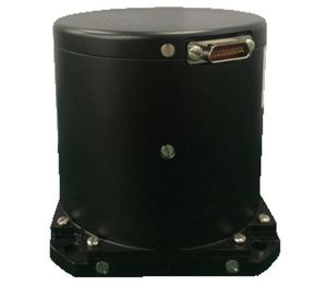
... Heave Apogee-A is a highly accurate Motion Reference Unit (MRU). The Apogee-A is based on the robust and cost-effective MEMS technology and provides precise orientation and heave data. 0.008° Roll and Pitch over 360° 0.015° ...
SBG Systems
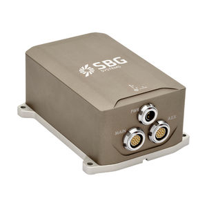
... applications and has a high level of health monitoring and instability prevention to ensure stable and reliable data. High-Performance MEMS Certus contains high performance MEMS ...
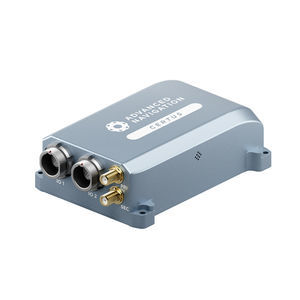
Advanced Navigation
... Inertial Systems High performance Inertial Systems with 6 axis for navigation The inertial systems combine angular ...
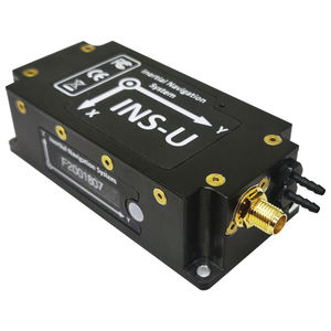
... The Inertial Labs GPS-Aided Inertial Navigation System (INS-U) is an IP67 rated version of the new generation, fully-integrated, combined Inertial Navigation ...
Inertial Labs, Inc.
the best suppliers