- Company
- Products
- Catalogs
- News & Trends
- Exhibitions
Post-processing software Qinertia UAVGNSS reference networksurveyingfor UAVs


Add to favorites
Compare this product
Characteristics
- Function
- post-processing
- Applications
- GNSS reference network, surveying, for UAVs
Description
Economical PPK for UAV
Qinertia UAV is an economical solution designed for UAV-based surveying and photogrammetry applications.
Qinertia accepts DJI P4 RTK native format and Matrice RTK with payload Zenmuse P1. This PPK software is compatible with RTK GNSS capable UAVs and photogrammetry suites including PIX4D, Agisoft, UAS Master, etc.
All sensors, All GNSS receivers
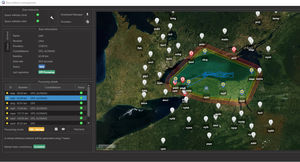
Processing trajectory within a 3km radius limit
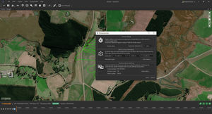
Photogrammetry: geotag image with precise position and orientation
All processing: INS/GNSS and GNSS Only
Bundle available when buying Quanta
VIDEO
Catalogs
Quanta Micro Leaflet
2 Pages
*Prices are pre-tax. They exclude delivery charges and customs duties and do not include additional charges for installation or activation options. Prices are indicative only and may vary by country, with changes to the cost of raw materials and exchange rates.


