
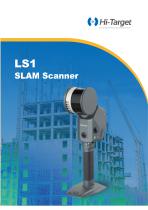
3D scanner LS1LIDARnot specifiedcompact

Add to favorites
Compare this product
Characteristics
- Number of axes
- 3D
- Technology
- LIDAR
- Application domain
- not specified
- Configuration
- compact, portable, integrated, fully integrated
- Other characteristics
- high-precision, simultaneous localization and mapping (SLAM)
- Measuring distance
Max.: 300 m
(984'03" )Min.: 1 m
(3'03" )
Description
Powered by industry-leading SLAM algorithms, the LS1 combines LiDAR, vision sensors, and integrated RTK capabilities to achieve real-time centimeter-level precision. It features full-scale, real-time color point cloud output and an instant accuracy display, providing professionals with intuitive and highly accurate data insights. Designed for seamless operation in diverse environments, the LS1 automatically adapts to both indoor and outdoor settings without the need for manual configuration, ensuring efficiency and reliability in any application.
Build-in RTK
1cm Relative Accuracy
<5cm Absolute Accuracy
3*5 MP Camera
Real-Time Colorization
Detachable Battery
180min Long Duration
Global Compatibility
Smart Coordinate System Conversion
- Compact All-in-One Design with Built-in RTK
The LS1 features a fully integrated design with no external antennas or add-ons, offering a sleek and simplified solution. It supports a“1+1”base station mode and direct CORS connection, enabling RTK-SLAM for real-time high-precision georeferenced point clouds. Additionally, the LS1 supports PPK-SLAM processing through its software, empowering users to tackle even the most complex and challenging environments with ease.
- Adaptive Scanning with Real-Time Accuracy Feedback
The LS1 intelligently adapts to diverse scanning environments, eliminating the need for manual mode selection. Capture dynamic scans effortlessly by walking through the job site, while the integrated accuracy heatmap provides real-time feedback on data quality. This visual tool allows users to monitor scan precision and identify areas requiring further attention, ensuring accurate and reliable results for any project.
- Effortless Scanning for Large-Scale Projects
The LS1 is designed for simple and quick scanning, allowing anyone to operate it with ease. Its real-time scene monitoring ensures accurate tracking of changes, while a 3-hour battery life makes it capable of handling large-scale environments effortlessly. With advanced data fusion from control points and RTK, along with automatic target recognition, the LS1 guarantees high-quality results for any project.
- Support Multiple Platform Operation Modes
It enables seamless transitions between handheld, backpack, vehicle-mounted, and airborne operations for diverse surveying needs.
Hi-LiDAR Processing Software(SLAM Function)
- SLAM Wizard Processing
One click process with automatic data filtering, georeferencing and colorization, help you easily to get the best result.
- Support Comprehensive Coordinate System
Compatible with global coordinate system, Geoid, re-projecting to get georeferenced and clean data.
- Support PPK Processing
Boost data accuracy and reliability with Post-Processing Kinematic (PPK) solutions, ensuring precise dynamic positioning for your projects even in areas without network coverage or signal obstruction.
AEC (Architecture, Engineering and Construction) Module
- Architecture
Effortless point cloud slicing and unfolding for seamless CAD geometry assistance.
- Engineering & Construction
Extracting precise horizontal and vertical sections to create detailed drawings for engineering analysis and project planning, simplifying the visualization of complex structures for infrastructure, construction, and diagnostics.
APP
- Live-streaming color point cloud
Perform in-app Editing and quick Volume Calculation
PC
- SLAM Process Wizard and Automatic Data Fusion
Volume function for detail comparison and report
Support PPK-SLAM, adopts comprehensive coordinate system, geoid and coordinate transform
Architectural Drawing Generation
Scenarios
Catalogs
Other Novatest products
Geodesy


Related Searches
- Test machine
- Measuring machine
- Indentation hardness tester
- Digital hardness tester
- Thickness measuring machine
- Manual test kit
- Portable indentation hardness tester
- 3D scanning system
- Extensometer
- Digital display thickness gauge
- Fault detector
- Compact scanning system
- High-precision scanning system
- Ultrasonic thickness measuring machine
- Portable scanning system
- Mobile fault detector
- Static load testing machine
- Precision level
- Portable fault detector
- Horizontal level
*Prices are pre-tax. They exclude delivery charges and customs duties and do not include additional charges for installation or activation options. Prices are indicative only and may vary by country, with changes to the cost of raw materials and exchange rates.