

{{product.productLabel}} {{product.model}}
{{#if product.featureValues}}{{product.productPrice.formattedPrice}} {{#if product.productPrice.priceType === "PRICE_RANGE" }} - {{product.productPrice.formattedPriceMax}} {{/if}}
{{#each product.specData:i}}
{{name}}: {{value}}
{{#i!=(product.specData.length-1)}}
{{/end}}
{{/each}}
{{{product.idpText}}}

... The HiScan-C is a fully integrated mobile mapping system with Hi-Target advanced 3D laser and geo-referenced digital imagery which proofed to be a perfect solution when a massive amount of asset data needs to be collected in a short time. ...
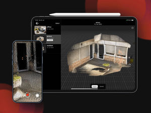
... . SiteScape, which features LiDAR-enabled 3D scanning for iOS devices, manages all three vectors with one simple app-based solution, capturing scale accurate 3D scans of buildings, rooms, and spaces with the simplicity ...
... : - Product type: Airborne Laser Scanning System - Integrated multi-directional 3D laser scanning - Forward and aft oblique RGB imagery - Nadir multispectral imaging (RGB and NIR) - High-end ...
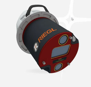
RIEGL LMS

Measuring distance: 2,300 m
... The VQ-1460 is one of RIEGL's latest high-end airborne laser scanning systems, suitable for a wide field of applications – from high-point density wide area mapping to ultra-high resolution city mapping or corridor mapping. The ...
RIEGL LMS
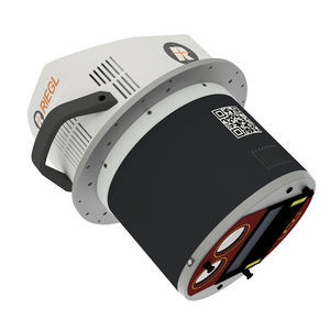
Measuring distance: 2,300, 5,400 m
... The VQ-1260 is one of RIEGL's latest high-end airborne laser scanning systems, suitable for a wide field of applications – from high-point density wide area mapping to ultra-high resolution city mapping or corridor mapping. The ...
RIEGL LMS
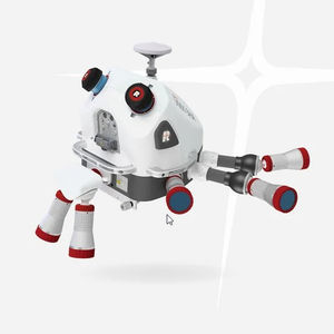
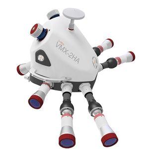
... the VMX-3HA Mobile Mapping System combines speed, precision, and efficiency in one powerful system – ready to take on complex projects with confidence. This powerful technology comprises two RIEGL VUX-3HA High Performance ...
RIEGL LMS
... Accuracy LiDAR sensors and a high performance IMU/GNSS unit, housed in an aerodynamically-shaped protective cover. Optional camera systems complement LiDAR data with precisely georeferenced images. The ...
RIEGL LMS
... Mobile Mapping Systems. The system enables data acquisition with up to 300 scan lines / second and up to 400 kHz Pulse Repetition Rate. To further increase efficiency of the mobile mapping system, ...
RIEGL LMS

Measuring distance: 280 m
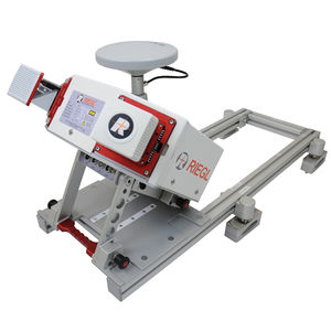
... extremely compact, economically priced Mapping System of small dimensions, that is well suited for a variety of basic mobile mapping applications. The central part of the system is one RIEGL miniVUX-Series LiDAR ...
RIEGL LMS
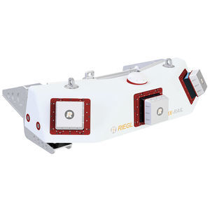
... RIEGL VMX-RAIL The RIEGL VMX-RAIL is a fully integrated Mobile Laser Scanning System for track mapping and clearance surveying. The triple scanner system design allows for utmost efficient capturing ...
RIEGL LMS
the best suppliers