
- Detection - Measurement
- Position, Speed and Acceleration Measurements
- UAV inertial navigation system
- SHAANXI ERICCO INERTIAL TECH. CO., LTD
- Company
- Products
- Catalogs
- News & Trends
- Exhibitions
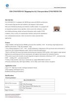
GNSS INS ER-GNSS/MINS-01miniaturewith integrated GPSfor UAVs

Add to favorites
Compare this product
Characteristics
- Options
- GNSS, miniature, with integrated GPS, for UAVs, ITAR-free, with integrated dual-antenna GPS
- Mounting
- standard, embedded, outdoor
Description
Remote, long-endurance MEMS integrated navigation and positioning system
Introduction
The ER-GNSS/MINS-01 is a navigation solution that integrates satellite
positioning and inertial measurement technology. It can provide navigation
information with mapping level accuracy and is the most accurate integrated
navigation system on the market that uses MEMS technology.
Features
1. It can provide accurate navigation and control information such as azimuth and attitude for fixed-wing aircraft/drones, airships, ships and vehicles.
2. It can also provide real-time/post processing high-precision position, velocity and attitude information as well as high-precision time scale information for various observation loads, which is widely used in aviation mapping, land mobile measurement and other fields.
3. Navigation grade MEMS gyro (bias instability <0.02°/h) and high precision MEMS accelerometer (bias instability <2ug) are used.
4. Built-in full frequency point and full system dual antenna positioning and orientation GNSS module, supports single antenna high precision positioning and speed measurement, supports dual antenna rapid orientation function.
5 Ultra-high precision, attitude 0.01°,post-processing 0.004°,heading 0.05°,post-processing 0.01°
6. In the environment of satellite signal loss, 60s high precision navigation is maintained, with attitude precision 0.01° and heading precision 0.01°.
Application areas
Large UAVs, flight data recorders, intelligent unmanned vehicles
Autonomous underwater vehicle (AUV) navigation
Urban mapping, hydrological surveying
Roadbed positioning and orientation
Catalogs
ER-GNSSMINS-01
10 Pages
Other SHAANXI ERICCO INERTIAL TECH. CO., LTD products
MEMS INS / FOG INS (Inertial Navigation System)


Related Searches
- Measuring machine
- Acceleration sensor
- Uniaxial accelerometer
- Automatic measuring machine
- Triaxial accelerometer
- Compact acceleration sensor
- High-precision measuring machine
- Analog accelerometer
- Industrial acceleration sensor
- Distance measuring machine
- MEMS acceleration sensor
- Accelerometer with built-in electronics
- Rugged accelerometer
- Miniature accelerometer
- Inertial navigation unit
- Accelerometer with TEDS
- Gyroscope
- Low-noise acceleration sensor
- GNSS INS
- Rugged measuring machine
*Prices are pre-tax. They exclude delivery charges and customs duties and do not include additional charges for installation or activation options. Prices are indicative only and may vary by country, with changes to the cost of raw materials and exchange rates.