
- Detection - Measurement
- Position, Speed and Acceleration Measurements
- UAV inertial navigation system
- SHAANXI ERICCO INERTIAL TECH. CO., LTD
- Company
- Products
- Catalogs
- News & Trends
- Exhibitions
GNSS INS ER-FINS-50miniaturelightweightfor UAVs

Add to favorites
Compare this product
Characteristics
- Options
- GNSS, miniature, lightweight, for UAVs, ITAR-free, with integrated dual-antenna GPS, with integrated GPS
- Mounting
- standard, embedded, horizontal, built-in
- Output signal
- CAN, RS-422, digital, RS-232
Description
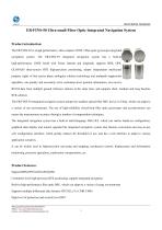
Ultra-Small Fiber Optic Integrated Navigation System
Product introduction
The ER-FINS-50 is a high-performance, ultra-compact GNSS +fiber-optic gyroscope integrated navigation system. It supports BDS, GPS, GLONASS three-system RTK high-precision positioning, adopts independent intellectual property rights of fast carrier phase ambiguity solution technology and multipath suppression algorithm, can quickly and accurately solve centimeter-level position information, can receive RTCM data from multiple ground reference stations at the same time, and supports short, medium and long baseline RTK solution.
The ER-FINS-50 integrated navigation system adopts the smallest optical fiber IMU device in China, which can adapt to a variety of use environments; The use of high-reliability closed-loop fiber optic gyroscopes and accelerometers can ensure the measurement accuracy through a number of compensation techniques.
It can be widely used in high-precision surveying and mapping, mechanical control, displacement and deformation monitoring, precision agriculture, exploration, transportation, etc.
Product Features
Support BDS/GPS/GLONASS/QZSS
Supports multiple differential data formats: RTCM2.x/3.x CMR CMR+
High level of protection and security level IP67
Flexible and abundant external interfaces, support serial port, Ethernet, CAN, USB 2.0 OTG, support TF card storage
Integrated DTU supports 4G transmission (can support global full Netcom)
Support NTP, FTP file download, FTP push, email abnormal alarm
Support Feiner custom ASCII and Binary format output, BINEX standard data format
Built-in web interface for board upgrades, configurations, controls, and status queries
Catalogs
ER-FINS-50
4 Pages
Other SHAANXI ERICCO INERTIAL TECH. CO., LTD products
MEMS INS / FOG INS (Inertial Navigation System)


Related Searches
- Measuring machine
- Acceleration sensor
- Uniaxial accelerometer
- Automatic measuring machine
- Triaxial accelerometer
- Compact acceleration sensor
- High-precision measuring machine
- Analog accelerometer
- Industrial acceleration sensor
- Distance measuring machine
- MEMS acceleration sensor
- Accelerometer with built-in electronics
- Rugged accelerometer
- Miniature accelerometer
- Inertial navigation unit
- Accelerometer with TEDS
- Gyroscope
- Low-noise acceleration sensor
- GNSS INS
- Rugged measuring machine
*Prices are pre-tax. They exclude delivery charges and customs duties and do not include additional charges for installation or activation options. Prices are indicative only and may vary by country, with changes to the cost of raw materials and exchange rates.