
- Company
- Products
- Catalogs
- News & Trends
- Exhibitions
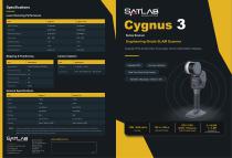
High-resolution LIDAR sensor Cygnus 3lightweightindustrial3D

Add to favorites
Compare this product
Characteristics
- Other characteristics
- industrial, high-resolution, for surveying, lightweight, 3D, for mapping
Description
Overview
SatLab Cygnus 3 is a portable engineering‑grade SLAM scanner designed for complex indoor and outdoor environments. By integrating LiDAR, three true‑color cameras, RTK/PPK positioning and advanced SLAM algorithms into a single compact system, it provides reliable colorized point clouds and engineering outputs for demanding surveying, mapping and inspection projects.
Key features
Benefits
Applications
Workflow & post‑processing
SatLiDAR wizard‑based workflow supports automated filtering, automatic colorization and automatic geo‑referencing via RTK/PPK streams. The integrated on‑device SLAM combined with SatLiDAR post‑processing delivers engineering‑grade alignment and export options to standard point cloud and mesh formats.
Technical specifications
SatLab Cygnus 3 is a portable engineering‑grade SLAM scanner designed for complex indoor and outdoor environments. By integrating LiDAR, three true‑color cameras, RTK/PPK positioning and advanced SLAM algorithms into a single compact system, it provides reliable colorized point clouds and engineering outputs for demanding surveying, mapping and inspection projects.
Key features
- Integrated sensors: LiDAR combined with three true‑color (RGB) cameras.
- Positioning: Built‑in GNSS antenna with RTK/PPK support and RTK‑assisted SLAM workflows.
- Connectivity: Integrated cellular module for remote workflow support and data transfer.
- Real‑time feedback: Live point cloud preview, live colorized visualization, route‑based accuracy heatmap and LED accuracy indicator for on‑site quality checks.
- Flexible deployment: Supports handheld, backpack, vehicle‑mounted and UAV‑mounted configurations for varied site conditions.
- Outputs: Single‑scan deliverables including colorized point clouds, mesh models and 3DGS exports.
Benefits
- Seamless indoor‑to‑outdoor capture with reduced dependence on closed‑loop paths.
- On‑site quality assurance reduces rework and missed coverage.
- One dataset supports multiple deliverables and streamlines post‑processing to accelerate delivery from field capture to analysis and visualization.
Applications
- Construction & building surveys
- Mining & tunnel mapping
- Stockpile and volumetric measurement
- Infrastructure corridors and utilities
- Industrial facility documentation
- Urban mapping and digital twin production
- Emergency response and rapid mapping
Workflow & post‑processing
SatLiDAR wizard‑based workflow supports automated filtering, automatic colorization and automatic geo‑referencing via RTK/PPK streams. The integrated on‑device SLAM combined with SatLiDAR post‑processing delivers engineering‑grade alignment and export options to standard point cloud and mesh formats.
Technical specifications
- Sensors: LiDAR + 3 true‑color cameras
- Positioning: Built‑in GNSS antenna, RTK/PPK support, RTK‑assisted SLAM
- Algorithms: Advanced SLAM for engineering‑grade point clouds
- Real‑time features: Point cloud preview, live color visualization, accuracy heatmap, LED indicator
- Deployment modes: Handheld, backpack, vehicle, UAV
- Post‑processing: SatLiDAR wizard with auto filtering, auto colorization, auto geo‑referencing
- Deliverables: Colorized point clouds, mesh models, 3DGS outputs
Catalogs
Other SatLab Geosolutions AB products
LiDAR System


*Prices are pre-tax. They exclude delivery charges and customs duties and do not include additional charges for installation or activation options. Prices are indicative only and may vary by country, with changes to the cost of raw materials and exchange rates.