
{{product.productLabel}} {{product.model}}
{{#if product.featureValues}}{{product.productPrice.formattedPrice}} {{#if product.productPrice.priceType === "PRICE_RANGE" }} - {{product.productPrice.formattedPriceMax}} {{/if}}
{{#each product.specData:i}}
{{name}}: {{value}}
{{#i!=(product.specData.length-1)}}
{{/end}}
{{/each}}
{{{product.idpText}}}
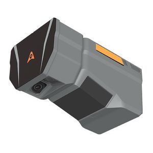
Distance range: 960 m - 2,100 m
... and mapping in mountainous or high‑relief areas.
CHC Navigation | CHCNAV
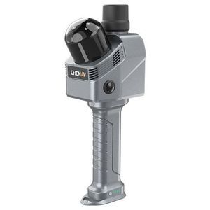
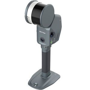
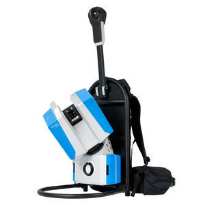
Distance range: 0 m - 40 m
... is a handheld real‑time 3 D LiDAR SLAM scanner designed for interior surveying, architectural documentation and BIM-related workflows. It combines high-rate LiDAR, a high‑precision IMU and SLAM/INS fusion ...
CHC Navigation | CHCNAV
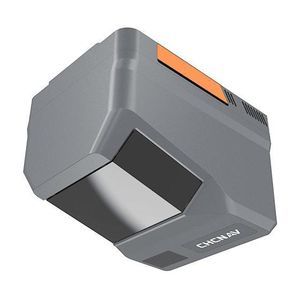
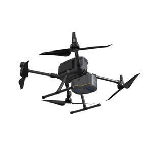
Distance range: 0 m - 2,100 m
... topographic surveying
Detailed description
The ...
CHC Navigation | CHCNAV

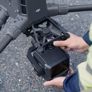
Distance range: 0.7 m
... , packing more power and accuracy into a tiny footprint than any other sensor. Designed for everything from wide-area mapping to corridor surveys, Galaxy is truly a universal sensor that rivals larger ...
... tunnel mapping
... navigating complex terrains or surveying urban environments with significant variations in structural heights, the Apus-MX UAV LiDAR is designed to deliver unparalleled efficiency and accuracy. Optimize your workflows, increase productivity, ...

The RIEGL VUX-1UAV²² is a very lightweight and compact laser scanner, meeting the challenges of emerging survey solutions by UAS/UAV/RPAS both in measurement performance as well as in system integration. With regard to the specific constraints and flight ...
RIEGL LMS
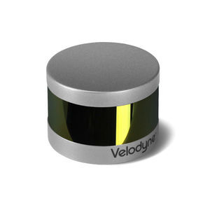
Distance range: 100 m
... retains the key features of Velodyne’s breakthroughs in LiDAR: Real-time, 360°, 3 D distance and calibrated reflectivity measurements. Real-Time 3 D LiDAR The VLP-16 has a range of ...
Distance range: 0 m - 300 m
... engineering‑grade SLAM laser scanner that integrates high‑density LiDAR, dual 48 MP panoramic imaging, built‑in RTK/GNSS and advanced SLAM algorithms. It produces georeferenced point clouds and 3 D outputs ready for surveying, ...
Distance range: 290 m - 2,000 m
... high-accuracy aerial LiDAR system. 950 m detection range, dual 100 MP cameras, 59-minute flight endurance. The DJI Matrice 400 + Zenmuse L3 is the benchmark enterprise solution for high-accuracy aerial topographic surveying, combining ...
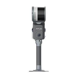
... includes a high-quality panoramic camera for colour
mapping of mobile point clouds. The camera delivers high colour fidelity and wide dynamic range images to support accurate visual inspection and textured 3
D models.
Project ...
the best suppliers