
{{product.productLabel}} {{product.model}}
{{#if product.featureValues}}{{product.productPrice.formattedPrice}} {{#if product.productPrice.priceType === "PRICE_RANGE" }} - {{product.productPrice.formattedPriceMax}} {{/if}}
{{#each product.specData:i}}
{{name}}: {{value}}
{{#i!=(product.specData.length-1)}}
{{/end}}
{{/each}}
{{{product.idpText}}}
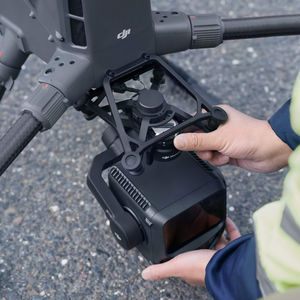
Distance range: 960 m - 2,100 m
... Overview
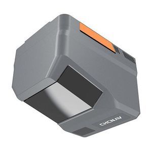
The CHCNAV AlphaAir 6 (AA6) is an airborne
LiDAR system designed for high‑density, long‑range aerial
surveying in complex and high‑relief environments. It pairs prism‑based long‑range laser scanning ...
CHC Navigation | CHCNAV
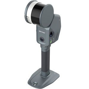
Distance range: 0 m - 40 m
... b>Overview
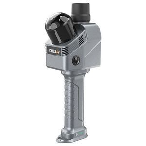
The CHCNAV RS7 is a handheld real‑time 3
D
LiDAR SLAM scanner designed for interior
surveying, architectural documentation and BIM-related workflows. It combines high-rate
LiDAR, ...
CHC Navigation | CHCNAV
Distance range: 0 m - 2,100 m
... Overview
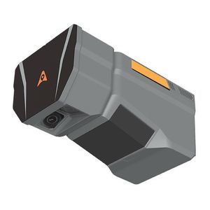
The CHCNAV AlphaAir 6 Dual (AA6D) airborne
LiDAR system is engineered for high‑resolution aerial
surveying over complex and high‑relief terrain. It integrates prism‑based long‑range laser scanning, ...
CHC Navigation | CHCNAV

Distance range: 0.7 m
... , packing more power and accuracy into a tiny footprint than any other sensor. Designed for everything from wide-area mapping to corridor surveys, Galaxy is truly a universal sensor that rivals larger systems with its ...
... environments. By integrating LiDAR, three true‑color cameras, RTK/PPK positioning and advanced SLAM algorithms into a single compact system, it provides reliable colorized point clouds and engineering outputs for demanding surveying, ...
... Unmatched Precision and Efficiency Whether you’re navigating complex terrains or surveying urban environments with significant variations in structural heights, the Apus-MX UAV LiDAR is designed to deliver unparalleled ...

The RIEGL VUX-1UAV²² is a very lightweight and compact laser scanner, meeting the challenges of emerging survey solutions by UAS/UAV/RPAS both in measurement performance as well as in system integration. With regard to the specific constraints and flight ...
RIEGL LMS
Distance range: 0.1 m - 180 m
... TF03 is a industrial high-speed LiDAR, It contains two versions with 100m and 180m. TF03 includes compensation algorithms for outdoor glare and other interference, so it works normally under strong light environment and rain, fog and ...
Benewake
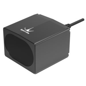
Distance range: 0 m - 300 m
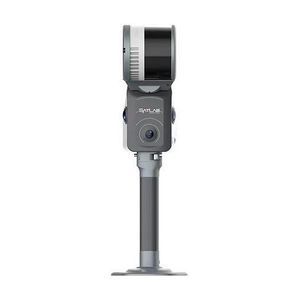
... SLAM laser scanner that integrates high‑density LiDAR, dual 48 MP panoramic imaging, built‑in RTK/GNSS and advanced SLAM algorithms. It produces georeferenced point clouds and 3 D outputs ready for surveying, ...
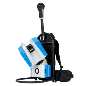
... and AEC applications such as building documentation, facility management, process plants, heritage recording and forensic
surveying.
Universal mounting The Z+F FlexScan® 22 is compatible with backpacks, tripod carts, fixed ...
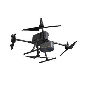
Distance range: 290 m - 2,000 m
... high-accuracy aerial LiDAR system. 950 m detection range, dual 100 MP cameras, 59-minute flight endurance. The DJI Matrice 400 + Zenmuse L3 is the benchmark enterprise solution for high-accuracy aerial topographic surveying, ...
the best suppliers