
{{product.productLabel}} {{product.model}}
{{#if product.featureValues}}{{product.productPrice.formattedPrice}} {{#if product.productPrice.priceType === "PRICE_RANGE" }} - {{product.productPrice.formattedPriceMax}} {{/if}}
{{#each product.specData:i}}
{{name}}: {{value}}
{{#i!=(product.specData.length-1)}}
{{/end}}
{{/each}}
{{{product.idpText}}}

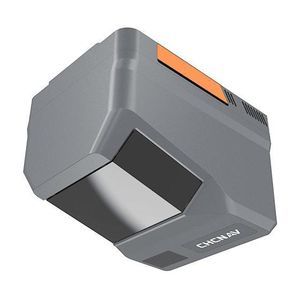
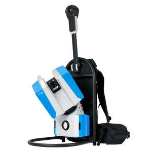
Distance range: 1,800 m
... The AlphaAir 15 (AA15) is a lightweight airborne LiDAR system developed by CHCNAV. It combines long-range scanning capability and high accuracy with an extremely fast data acquisition rate, all in a compact design. The AA15 is ideal for ...
CHC Navigation | CHCNAV
Distance range: 960 m - 2,100 m
... Overview
The CHCNAV AlphaAir 6 (AA6) is an airborne
LiDAR system designed for high‑density, long‑range aerial surveying in complex and high‑relief environments. It pairs prism‑based long‑range laser scanning with a high‑grade ...
CHC Navigation | CHCNAV
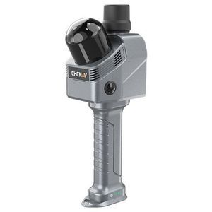
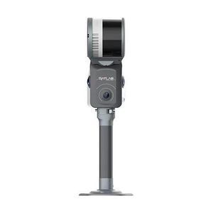
Distance range: 0 m - 40 m
... b>Overview
The CHCNAV RS7 is a handheld real‑time 3
D
LiDAR SLAM scanner designed for interior surveying, architectural documentation and BIM-related workflows. It combines high-rate
LiDAR, a high‑precision ...
CHC Navigation | CHCNAV

Distance range: 0.2 m - 10 m
... The R2300 3-D LiDAR sensor is equipped with Pulse Ranging Technology (PRT), which provides reliable and extremely precise measurements with high accuracy and short response times. PRT continuously measures a target’s ...

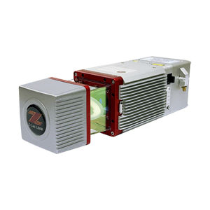
Distance range: 0.7 m
... , packing more power and accuracy into a tiny footprint than any other sensor. Designed for everything from wide-area mapping to corridor surveys, Galaxy is truly a universal sensor that rivals larger systems with its ...
Optech
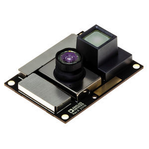
Distance range: 0.4 m - 4 m
... The ADTF3175 is a complete Time-of-Flight (ToF) module for high resolution 3 D depth sensing and vision systems. Based on the ADSD3100, a 1 Megapixel CMOS indirect Time-of-Flight (iToF) imager, the ADTF3175 also integrates the lens and ...
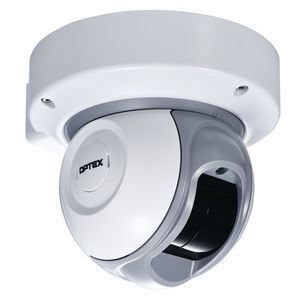
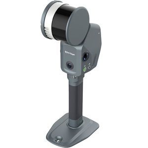
Distance range: 30 m
... Product overview
The REDSCAN RLS-2020S is a compact indoor/outdoor Grade 3
LiDAR security
sensor providing a configurable virtual wall or plane with detection coverage up to 20 x 20 m (95°) or up to 30 m radius ...
OPTEX SEC Division
... engineering outputs for demanding surveying, mapping and inspection projects.
Key features
- Integrated sensors: LiDAR combined with three true‑color (RGB) cameras.
- Positioning: Built‑in
... navigating complex terrains or surveying urban environments with significant variations in structural heights, the Apus-MX UAV LiDAR is designed to deliver unparalleled efficiency and accuracy. Optimize your workflows, increase productivity, ...

Distance range: 5.6 m
... 2D 4-Channel Laser Scanners (to be discontinued) The LiDAR sensors LSE series feature 5.6 m x 5.6 m detection area (90˚) to accurately detect object presence. The scanners offer 4 separate laser beam channels which ...
Autonics
Distance range: 30, 10, 15, 20 m
... angle scanning Replacing traditional LIDAR sensing solution, Achieving the same effect, Completely meets the needs of small, conventional mobile robots in applications. The top-of-the-line automotive-grade LiDAR ...
... ISO 26262), a significant footprint in 3 D consumer electronics, and capabilities to co-develop emitter, current driver and optics. LiDAR & Direct Time of Flight LiDAR (Light Detection and Ranging) ...

The RIEGL VUX-1UAV²² is a very lightweight and compact laser scanner, meeting the challenges of emerging survey solutions by UAS/UAV/RPAS both in measurement performance as well as in system integration. With regard to the specific constraints and flight ...
RIEGL LMS
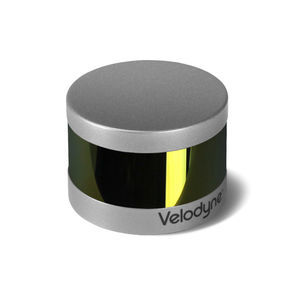
Distance range: 100 m
... retains the key features of Velodyne’s breakthroughs in LiDAR: Real-time, 360°, 3 D distance and calibrated reflectivity measurements. Real-Time 3 D LiDAR The VLP-16 has a range of ...
Distance range: 0.2 m - 20 m
... LRA7 millimeter wavelength lidar is an electromagnetic wave radar that detect obstacles ahead. It has great anti-interference performance and detection capabilities in dust, smoke and water environment. And is suitable for complex industrial ...
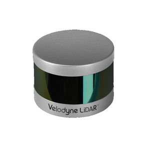
Distance range: 100 m
... Expanding on Velodyne LiDAR's groundbreaking VLP-16 Puck, a 16-channel, real-time 3 D LiDAR sensor that weighs just 830 grams, Puck Hi-Res is used in applications that require greater ...
Velodynelidar
Distance range: 0.1 m - 180 m
... TF03 is a industrial high-speed LiDAR, It contains two versions with 100m and 180m. TF03 includes compensation algorithms for outdoor glare and other interference, so it works normally under strong light environment and rain, fog and ...
Benewake

... Revolutionary 4D LiDAR Technology Leveraging Aeva’s unique Frequency Modulated Continuous Wave (FMCW) 4D technology and the world’s first LiDAR-on-chip silicon photonics design, Aeries II’s capabilities go beyond today’s ...
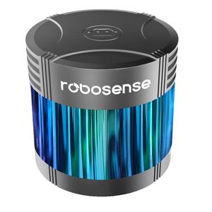
Distance range: 200 m
... and delivery robots. Please watch the video below for reference on how to use 3D- LiDAR. RoboSense 3D- LiDAR lineup RoboSense's 3D- LiDAR products include mechanical RS- LiDAR 16 and ...
ZMP
Distance range: 0 m - 300 m
... engineering‑grade SLAM laser scanner that integrates high‑density LiDAR, dual 48 MP panoramic imaging, built‑in RTK/GNSS and advanced SLAM algorithms. It produces georeferenced point clouds and 3 D outputs ready for surveying, ...
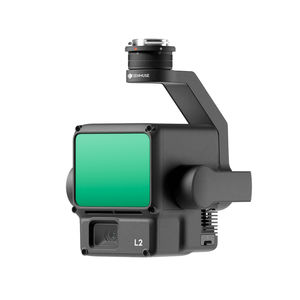
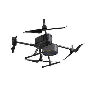
Distance range: 450, 250 m
... Zenmuse L2 integrates frame LiDAR, a self-developed high-accuracy IMU system, and a 4/3 CMOS RGB mapping camera, providing DJI flight platforms with more precise, efficient, and reliable geospatial data acquisition. When used with DJI ...
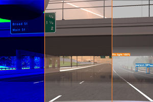
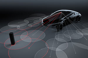
... up multi- sensors simulation in SiL or HiL context toguarantee your ADAS/AV system performance under any operating condition. Radar. LiDAR Sensor Camera Sensor Thermal ...
... . The camera delivers high colour fidelity and wide dynamic range images to support accurate visual inspection and textured 3
D models.
Project efficiency The platform supports project-adaptive configurations. Scanner and ...
Distance range: 250 m
... Mini LiDAR System SZT-R250 Maximum working range 250 m Automotive scanning roadway up to 432 km per day Airborne scanning area coverage up to 14 sq.km per day Integrated weight only 2.1 kgs SUV/UAV/All-Terrain-Vehicle multi-platforms ...
South Surveying & Mapping Instrument Co., Ltd
the best suppliers