
{{product.productLabel}} {{product.model}}
{{#if product.featureValues}}{{product.productPrice.formattedPrice}} {{#if product.productPrice.priceType === "PRICE_RANGE" }} - {{product.productPrice.formattedPriceMax}} {{/if}}
{{#each product.specData:i}}
{{name}}: {{value}}
{{#i!=(product.specData.length-1)}}
{{/end}}
{{/each}}
{{{product.idpText}}}

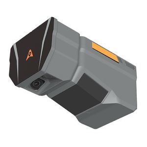
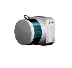
Distance range: 960 m - 2,100 m
... The CHCNAV AlphaAir 6 (AA6) is an airborne LiDAR system designed for high‑density, long‑range aerial surveying in complex and high‑relief environments. It pairs prism‑based long‑range laser scanning with ...
CHC Navigation | CHCNAV
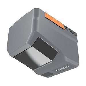
Distance range: 0 m - 2,100 m
... technology, a 500 Hz high‑grade IMU and 5th‑generation RWP to deliver high‑density, high‑completeness point clouds at flight altitudes between 100 and 600 m AGL. Dual APS‑C cameras provide wide‑FOV, high‑ resolution ...
CHC Navigation | CHCNAV
Distance range: 960 m - 2,100 m
... 6 (AA6) is an airborne LiDAR system combining long-range prism scanning, a high-grade IMU and switchable 100/25 MP imaging modes for efficient aerial surveying and mapping on UAV and manned platforms. Designed for complex, ...
CHC Navigation | CHCNAV

Distance range: 0.2 m - 10 m
... single-layer scanner can be used in high-speed applications due to its increased scan rate of 100 Hz. With a very high angular resolution of 0.1 °, a high sampling rate, and a precise ...
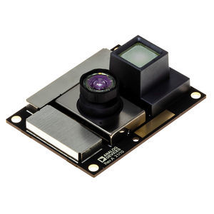
Distance range: 0.4 m - 4 m
... The ADTF3175 is a complete Time-of-Flight (ToF) module for high resolution 3 D depth sensing and vision systems. Based on the ADSD3100, a 1 Megapixel CMOS indirect Time-of-Flight (iToF) imager, the ADTF3175 ...
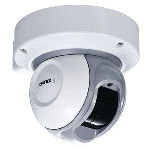
Distance range: 30 m
... REDSCAN LiDAR series
OPTEX SEC Division
... engineering outputs for demanding surveying, mapping and inspection projects.
Key features
- Integrated sensors: LiDAR combined with three true‑color (RGB) cameras.
- Positioning: Built‑in

... interface. The RIEGL VUX-1UAV²² provides highspeed data acquisition using a narrow infrared laser beam and a fast line scanning mechanism. High-accuracy laser ranging is based on RIEGL's unique echo digitization and ...
RIEGL LMS
Distance range: 100 m
... Expanding on Velodyne LiDAR's groundbreaking VLP-16 Puck, a 16-channel, real-time 3 D LiDAR sensor that weighs just 830 grams, Puck Hi-Res is used in applications that require greater ...
Distance range: 0.1 m - 300 m
... Waterproof and dust-proof 3.HD LARGE FIELD OF VIEW 90 °(horizontal) * 30 °(vertical) wide-angle detection, high coverage makes the application easier, the algorithm more concise, and the outcome more reliable. 4. HIGH ...
Benewake

... s legacy Time-of-Flight LiDAR sensors. Camera-Level Ultra ResolutionTM Aeva’s proprietary 4D Perception™ software delivers real-time camera-level resolution that provides up to 20 times the resolution ...
Distance range: 0 m - 300 m
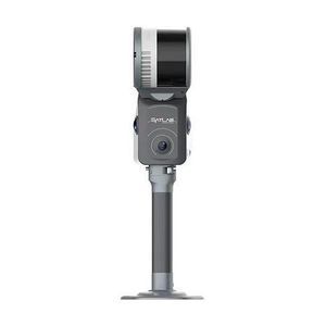
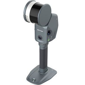
... engineering‑grade SLAM laser scanner that integrates high‑density LiDAR, dual 48 MP panoramic imaging, built‑in RTK/GNSS and advanced SLAM algorithms. It produces georeferenced point clouds and 3 D outputs ...
Distance range: max 100.0 m
... Absolute accuracy down to 10 cm extremely lightweight, less than 1.5 kg an economical LiDAR solution multi-platform (UAV/SUV) applications ...
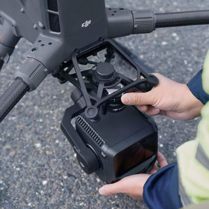
Distance range: 290 m - 2,000 m
... Overview
DJI’s first long-range,
high-accuracy aerial
LiDAR system. 950 m detection range, dual 100 MP cameras, 59-minute flight endurance. The DJI Matrice 400 + Zenmuse L3 is the benchmark enterprise solution ...
the best suppliers