
{{product.productLabel}} {{product.model}}
{{#if product.featureValues}}{{product.productPrice.formattedPrice}} {{#if product.productPrice.priceType === "PRICE_RANGE" }} - {{product.productPrice.formattedPriceMax}} {{/if}}
{{#each product.specData:i}}
{{name}}: {{value}}
{{#i!=(product.specData.length-1)}}
{{/end}}
{{/each}}
{{{product.idpText}}}

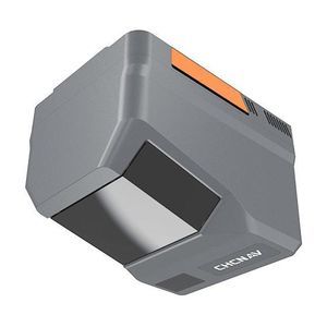
Distance range: 1,800 m
... The AlphaAir 15 (AA15) is a lightweight airborne LiDAR system developed by CHCNAV. It combines long-range scanning capability and high accuracy with an extremely fast data acquisition rate, all in a compact design. The ...
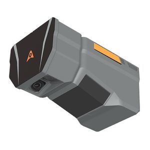
Distance range: 960 m - 2,100 m
... : single camera 25 MP (4/3" CMOS, switchable to 100 MP) or dual‑camera AA6D with two APS‑C sensors (26 MP ×2) and ultra‑wide 110° FOV.
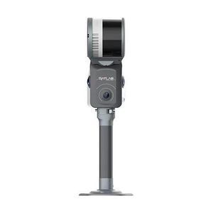
Distance range: 0 m - 2,100 m
... cameras provide wide‑FOV, high‑resolution imagery synchronized with LiDAR data. Open interface protocols simplify integration across multirotor and fixed‑wing UAVs while the lightweight form factor and user‑swappable ...

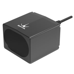
Distance range: 0.2 m - 10 m
... The R2300 3-D LiDAR sensor is equipped with Pulse Ranging Technology (PRT), which provides reliable and extremely precise measurements with high accuracy and short response times. PRT continuously measures a target’s ...
... engineering outputs for demanding surveying, mapping and inspection projects.
Key features
- Integrated sensors: LiDAR combined with three true‑color (RGB) cameras.
- Positioning: Built‑in
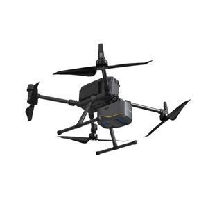
... navigating complex terrains or surveying urban environments with significant variations in structural heights, the Apus-MX UAV LiDAR is designed to deliver unparalleled efficiency and accuracy. Optimize your workflows, increase productivity, ...
Distance range: 100 m
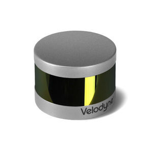
... retains the key features of Velodyne’s breakthroughs in LiDAR: Real-time, 360°, 3 D distance and calibrated reflectivity measurements. Real-Time 3 D LiDAR The VLP-16 has a range of ...
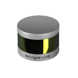
Distance range: 100 m
... latter. No other changes have been made to Puck LITE™ as it retains its patented 360° surround view to capture real-time 3 D LiDAR data that includes distance and calibrated reflectivity measurements. ...
Distance range: 0.1 m - 180 m
... TF03 is a industrial high-speed LiDAR, It contains two versions with 100m and 180m. TF03 includes compensation algorithms for outdoor glare and other interference, so it works normally under strong light environment and rain, fog and ...
Benewake
Distance range: 250 m
... Mini LiDAR System SZT-R250 Maximum working range 250 m Automotive scanning roadway up to 432 km per day Airborne scanning area coverage up to 14 sq.km per day Integrated weight only 2.1 kgs SUV/UAV/All-Terrain-Vehicle multi-platforms ...
South Surveying & Mapping Instrument Co., Ltd
the best suppliers