
{{product.productLabel}} {{product.model}}
{{#if product.featureValues}}{{product.productPrice.formattedPrice}} {{#if product.productPrice.priceType === "PRICE_RANGE" }} - {{product.productPrice.formattedPriceMax}} {{/if}}
{{#each product.specData:i}}
{{name}}: {{value}}
{{#i!=(product.specData.length-1)}}
{{/end}}
{{/each}}
{{{product.idpText}}}
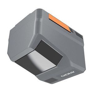
Distance range: 960 m - 2,100 m
... Imaging options: single camera 25 MP (4/ 3" CMOS, switchable to 100 MP) or dual‑camera AA6 D with two APS‑C sensors (26 MP ×2) and ultra‑wide 110° FOV.
CHC Navigation | CHCNAV
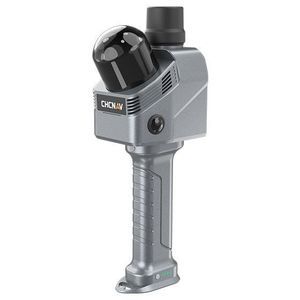
Distance range: 0 m - 40 m
... Vertical ≤ 3 cm RMS.
CHC Navigation | CHCNAV
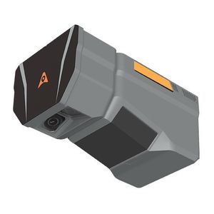
Distance range: 0 m - 2,100 m
... Overview
The CHCNAV AlphaAir 6 Dual (AA6
D) airborne
LiDAR system is engineered for high‑resolution aerial surveying over complex and high‑relief terrain. It integrates prism‑based long‑range laser scanning, ...
CHC Navigation | CHCNAV

Distance range: 450 m
... AlphaAir450: Airborne LiDAR system with built-in IMU, GNSS, 3D scanner, and camera Overview: The AlphaAir 450 (AA450) is a major breakthrough in 3D mobile mapping technology, allowing its use by non-professional ...
CHC Navigation | CHCNAV